REVIEW · RICHMOND
Hiking the James River in Richmond, VA
Book on Viator →Operated by Discover Richmond Tours · Bookable on Viator
A morning on the James River turns into a mini story tour. You’ll hike with an intimate group (up to 12) on a mostly flat route through the James River Park System, with a local guide sharing what you’re looking at and why it matters. I especially like the small-group feel—it stays friendly and questions are welcome.
I also like that the scenery is practical, not just pretty. You’ll cross the river via a pedestrian bridge, then work your way past spots tied to Richmond’s outdoor culture and industrial past, including Belle Isle and the Pipeline Trail area. One possible drawback to plan for: the meeting point at 500 W 7th St can be a little confusing for rideshare drivers, so I recommend building in extra time to arrive on the dot.
In This Review
- Key things to know before you lace up
- Why Richmond’s James River Park System feels made for walking
- The intimate guided format (and why it changes the whole hike)
- Route rundown: Belle Isle, the Flood Wall Trail area, and the river-crossing views
- Belle Isle: open views, river energy, and classic park walking
- The James River Park area and Flood Wall Trail: where the history becomes visible
- Manchester Climbing Wall and Pipeline Trail vibes: outdoor culture meets the river corridor
- Park wildlife (and the “look down and look up” method)
- What the hike is like in real terms: distance, terrain, and pacing
- What’s included (and how that affects your day)
- Timing, weather, and what to expect from different seasons
- Getting there near 500 W 7th St in Richmond
- Who this hike is perfect for (and who it may not be)
- Should you book this James River Richmond hike?
- FAQ
- How long is the hike on the James River?
- How far will I walk?
- Is the terrain flat or hilly?
- Where does the hike start?
- What are the main stops?
- Is the hike accessible for service animals and public transportation?
Key things to know before you lace up

- Small group size (max 12) keeps the pace comfortable and the conversation flowing
- Easy-to-moderate, 3–4 miles means you get exercise without a full-day grind
- Pedestrian bridge river crossing adds a real “walk-and-see” change of scenery
- Belle Isle plus Flood Wall Trail area gives you both open views and history-related stops
- Bring hiking shoes because you’ll mix paved/gravel paths with a few stairs and some rocky ground
Why Richmond’s James River Park System feels made for walking
Richmond has a way of hiding its best views in plain sight. The James River Park System puts water, trees, and historic infrastructure close enough that you can experience it on foot without needing a car.
This hike is a sweet spot if you want both: a real walk and real context. Instead of simply passing by landmarks, you’re moving through the landscapes that helped shape the city—while still getting that satisfied, legs-forward feeling that comes from a 1.5 to 2 hour outing.
The intimate guided format (and why it changes the whole hike)

The biggest reason this hike works is the group size. With no more than 12 people, you’re not stuck in a line. Your guide can adjust pace, point out details, and actually explain what you’re seeing.
Guides you might meet include Lori and Erin. In the small-group setting, their style shows up fast: Lori’s approach comes through as upbeat and story-driven, with fun facts that make landmarks feel personal. Erin’s vibe also fits the experience well—cheerful, easy to talk to, and focused on helping you understand how the river area has been used by different kinds of people over time.
And it’s not only talk. One highlight from the group: Lori even stopped to take photos of the group in scenic spots and shared mini Polaroids afterward. That’s the kind of thoughtful touch that makes this feel less like a generic hike and more like a Richmond morning you’ll remember.
Route rundown: Belle Isle, the Flood Wall Trail area, and the river-crossing views
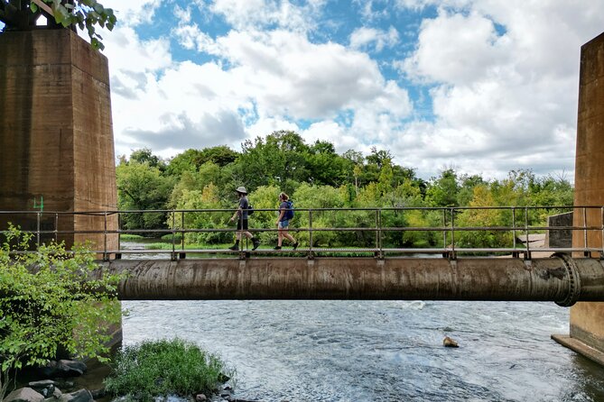
This hike is designed so you see multiple “sides” of Richmond in a compact time window. Even though the route is mostly flat, the variety keeps it interesting.
Belle Isle: open views, river energy, and classic park walking
Belle Isle is a strong first stop because it’s easy to picture Richmond’s outdoor identity there. You’ll spend time walking around this area as part of the river corridor, with plenty of spots to look out over the water and notice how the park breaks up the city feel.
What I like about starting here is how it sets the tone. You get the scenic payoff early, and then the rest of the hike makes more sense. As the guide connects what you see to Richmond’s broader story, Belle Isle becomes the “orientation point” for the route.
A practical note: you’ll want comfortable grip. The walk mixes paved and dirt/gravel segments, so your shoes matter.
The James River Park area and Flood Wall Trail: where the history becomes visible
After Belle Isle, you’ll move toward the James River Park area with a stop on the Flood Wall Trail. This is where the hike shifts from mostly scenery to more layered observation.
Flood walls and industrial-era ruins can feel abstract until you walk near them. With a guide explaining the why, you start seeing how infrastructure shaped the river edges—both for industry and for the city’s ongoing use of the shoreline.
This stop also helps you understand why Richmond’s riverfront isn’t just a view. It’s part of how the city worked.
Manchester Climbing Wall and Pipeline Trail vibes: outdoor culture meets the river corridor
Along the route, you’ll also pass through areas tied to modern outdoor use, including the Manchester Climbing Wall and the Pipeline Trail. Even if you’re not climbing or trail-running, you’ll feel the difference between a river “edge” and a river “path”—the way people actually move through this landscape.
These areas add variety without turning the hike into something technical. You get a strong sense that the river corridor is both a destination and a connector.
Park wildlife (and the “look down and look up” method)
You’ll have chances to spot park wildlife. The key is to slow your pace at the guide’s prompts—look down for tracks or ground movement, then look up at the treeline line. In a river park like this, small changes in light and wind make a big difference, so taking the couple seconds to pause matters more than you’d expect.
What the hike is like in real terms: distance, terrain, and pacing

This is an easy-to-moderate hike that runs about 1.5 to 2 hours, covering roughly 3–4 miles. The route is mostly flat, with a mix of dirt paths and paved paths. You’ll also hit a few staircases and at least one stretch of rocky terrain.
That mix is why I call it a great “starter” hike for many visitors. You can keep a steady rhythm, and you’re not dealing with constant steep climbs. Still, it’s not a slick, flat stroll either. The stairs and rocky bit are enough to remind you to wear proper footwear and not rely on sneakers with no traction.
I’d come in with moderate physical fitness. If you’re comfortable walking 30 to 60 minutes on mixed surfaces, you’re likely in the right zone. If not, you can still enjoy the route—just expect to take your time through the stairs and rocky stretch.
What’s included (and how that affects your day)

This experience includes a professional local guide, and you’ll get a mobile ticket. That matters because the time you spend is guided time. You’re not guessing where to look, and you’re not trying to figure out how the history and infrastructure connect while your legs are already working.
The price is $38 per person for about a two-hour outing. For me, the value comes from the combination of three things:
- You’re paying for guided interpretation, not just walking access
- The group is small, so you actually get attention
- You get multiple stops in one loop, including Belle Isle and the Flood Wall Trail area
They also mention group discounts, which can make it even more attractive if you’re traveling with friends.
Timing, weather, and what to expect from different seasons
This hike depends on good weather. The river park environment makes sense—paths can get slippery, and the rocky section is less fun when conditions turn.
One review highlight calls out winter as surprisingly great when the day is sunny. That tells me the seasonal payoff is real: the scenery changes, but the route stays a manageable length. If you can, check the forecast and aim for a bright day. You’ll feel it immediately in the walking experience and in how enjoyable the river views are.
Getting there near 500 W 7th St in Richmond
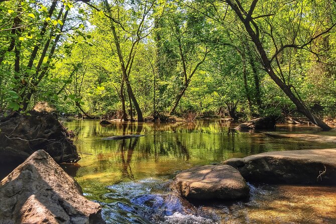
The meeting point is at 500 W 7th St, Richmond, VA 23224, and the hike ends back at the starting point. That round-trip layout is convenient because it keeps you from having to coordinate later transportation.
One practical thing to watch: the address is sometimes tricky for rideshare navigation. An Uber driver reportedly had trouble finding it, and the fix was simply arriving early and getting your bearings before the start. If you’re using rideshare, give yourself a buffer of extra time so you’re not sprinting to the trail.
Who this hike is perfect for (and who it may not be)
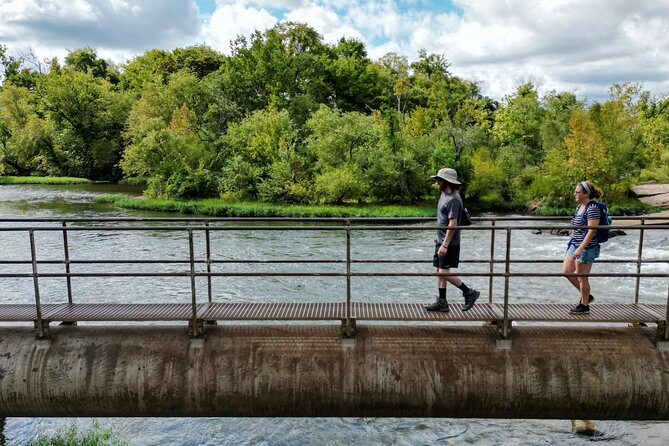
This fits you if you want:
- A Richmond experience that mixes outdoor time and local context
- A workout that stays in the easy-to-moderate zone
- A guided walk where you’ll actually get answers, not just directions
It’s also a good option if you’re a local visitor, not only a tourist. The format is built for getting fresh perspective on a familiar city section.
If you’re someone who wants a very technical challenge, this won’t be that kind of hike. The route is mostly flat, with only a few stairs and one rocky patch. Think steady walking and sight-seeing with light effort, not a strenuous scramble.
Should you book this James River Richmond hike?
If you want a well-paced way to see Belle Isle and connect Richmond’s river scenery to the city’s industrial and Civil War-era footprint, I think you should book it. For $38, you’re buying guided interpretation plus a scenic walking route that lasts long enough to feel like an outing, but short enough to fit into a packed day.
The small group size is the deal-maker. With up to 12 people, the hike feels more personal, and that makes the history stops land better. Just plan for the one real snag: the meeting point can be confusing, so arrive early and get oriented.
FAQ
How long is the hike on the James River?
The hike runs about 2 hours total, and the walking portion is roughly 1.5 to 2 hours.
How far will I walk?
The route is about 3–4 miles long.
Is the terrain flat or hilly?
It’s mostly flat, with a mix of dirt paths and paved paths, plus a few staircases and one stretch of rocky terrain.
Where does the hike start?
The meeting point is 500 W 7th St, Richmond, VA 23224, USA, and the tour ends back at the same meeting point.
What are the main stops?
You’ll visit Belle Isle and the James River Park area on the Flood Wall Trail, and the route also includes sights like the Manchester Climbing Wall and the Pipeline Trail.
Is the hike accessible for service animals and public transportation?
Service animals are allowed, and the meeting point is near public transportation. The hike does require a moderate physical fitness level.