REVIEW · MOUNT COOK
Glentanner High Country Heli Hike
Book on Viator →Operated by Glentanner High Country Heli Hike · Bookable on Viator
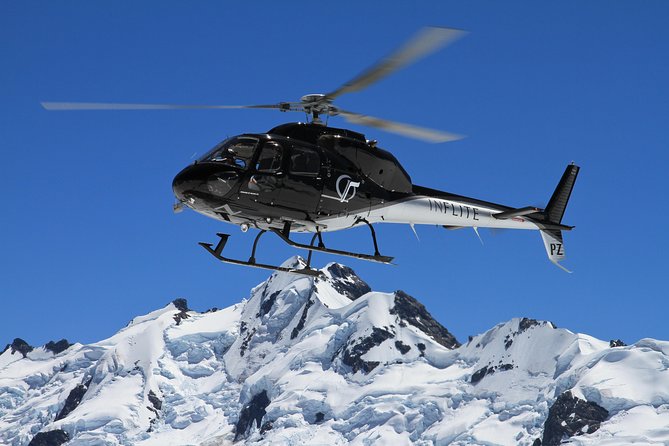
Helicopter views you can’t fake. The Glentanner High Country Heli Hike in South Island pairs an 8-minute flight over Aoraki Mount Cook National Park and Lake Pukaki with a guided walk in the glacier-carved high country. It’s the kind of trip where you see the Southern Alps from more than one angle—sky and ground—without spending the whole day on the road.
I also like the on-the-ground stop at a restored historic field station. You get a break that’s not just comfortable, but meaningful, with hot drinks and snacks, plus time to ask questions in a small group. One watch-out: this tour expects a moderate fitness level and you still need to bring proper hiking footwear and weather-appropriate clothing—the scenery is easy to love, but preparation matters.
In This Review
- Key things to know before you go
- Aoraki and Pukaki from above: the fast track to mind-blowing views
- Meet at Glentanner: timing, group size, and what your day feels like
- Flight over Aoraki Mount Cook National Park: what you’ll actually see
- The 7km 4×4 track and glacier-carved terrain: scenery with context
- Lake Pukaki again—plus Tasman River Delta views during the hike
- Restored historic field station stop: snacks, hot drinks, and real stories
- The hike: 4 hours with breaks, flat-ish sections, then more downhill
- What’s included vs what you must bring (so you don’t get cold)
- Value check: is $307.18 worth it?
- Guide Brian and the power of a flexible plan
- Should you book the Glentanner High Country Heli Hike?
- FAQ
- How long is the Glentanner High Country Heli Hike?
- What’s included in the tour?
- What should I bring?
- Where is the meeting point?
- How large is the group?
- What happens if the weather is poor?
Key things to know before you go
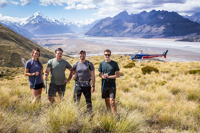
- Short helicopter time (8 minutes): enough for big views, without turning the day into a long transit marathon.
- Glentanner High Country focus: your hike is built around ancient glaciers and the way they shaped the region.
- Photo-friendly viewpoints: Aoraki Mount Cook National Park and Lake Pukaki show up from both the helicopter and the hike.
- Restored historic field station: snacks plus hot drinks, with a story-driven stop along the way.
- Small-group experience (max 15): you’ll have real chances to ask your guide questions.
- Gear provided, clothing not: hiking poles come with the tour; shoes and layers are on you.
Aoraki and Pukaki from above: the fast track to mind-blowing views
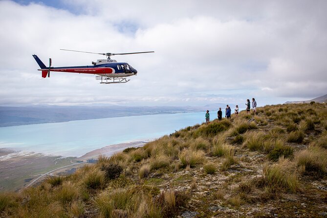
What makes this heli hike work is the ratio. You’re not waiting hours for a viewpoint, and you’re not stuck in one “best view only” moment. The flight is short—about 8 minutes—but it’s timed to give you aerial perspective over places you’ve probably only seen from maps and photos.
From the air, you’ll get views tied directly to the tour’s theme: the Southern Alps and the glacier history behind them. If you love photography, this is where the visuals click. The group can look down, orient themselves, and then later compare what you saw in the helicopter with what you walk through on the ground.
Lake Pukaki is the other big highlight. It’s known for striking blue tones, and the tour gives you a birds-eye view during the helicopter ride. Then, you’ll see it again during the hike, along with views toward the Tasman River Delta. That “see it twice” setup is a smart way to turn scenery into a story you can actually follow.
Meet at Glentanner: timing, group size, and what your day feels like
You’ll start at 3388 Mount Cook Road, Glentanner 7999, New Zealand, and the activity ends back at the meeting point. The full experience runs about 4 hours. That half-day length is a sweet spot in this region: enough time for helicopter views and a real walk, but not so long you lose your entire day to logistics.
This is also a maximum 15-person tour, which changes the vibe. You’re not sharing your guide with dozens of people at once. It’s built for questions, quick clarifications, and small moments—like when you realize you’re standing in a spot that looks different after the guide points out what shaped it.
A practical note: the tour expects a moderate physical fitness level. Most people with street-level fitness should enjoy it, but you should be comfortable walking for several hours with stops. The good news from past groups is that the pace includes breaks—lots of them—so it doesn’t feel like a nonstop march.
Flight over Aoraki Mount Cook National Park: what you’ll actually see
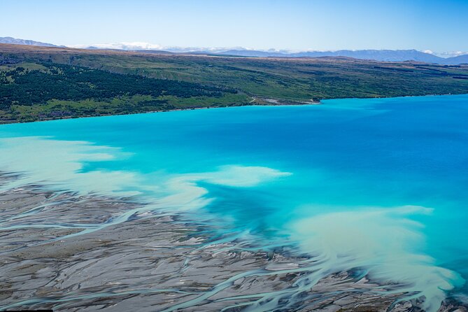
The first major “wow” comes during the scenic helicopter flight. You’ll get views of Aoraki Mount Cook National Park, which is the anchor of the whole area. Seeing the park from above helps you understand why the glaciers mattered. It’s not abstract. You can often spot how ridges, valleys, and slopes relate to each other—then later connect those shapes to the story your guide is telling.
Expect this to be photo-heavy. A helicopter gives you moving angles you can’t get from a single viewpoint on a roadside pull-off. The flight also helps you get your bearings fast. By the time the tour moves onto the ground, you’re not guessing where you are—you’re recognizing the terrain.
One more detail that matters: your flight is paired with time on a well maintained 4×4 track. That means you’re not bouncing around endlessly. You’re moving through the region, then stepping out for the hike with visuals you already understand from above.
The 7km 4×4 track and glacier-carved terrain: scenery with context
After the helicopter portion, the tour shifts gears into the kind of travel that’s easy to underestimate: scenic driving on a 7km, well maintained 4×4 track. It’s not “just transport.” It’s part of the experience. You’ll continue getting stunning views—especially of Aoraki Mount Cook National Park—while transitioning into the hiking area.
This is also where glacier history becomes more than a line in a brochure. The high country here was shaped by ice long before any hiking boot touched these paths. Your guide’s job is to translate that into what you can see: the shapes of slopes, the way valleys open, and why some areas look smoother or more rugged than others.
What I like about this approach is that you don’t have to be a geology expert to get something from it. You simply need to look where your guide points and connect the dots between the helicopter view and the ground you’re walking on.
Lake Pukaki again—plus Tasman River Delta views during the hike
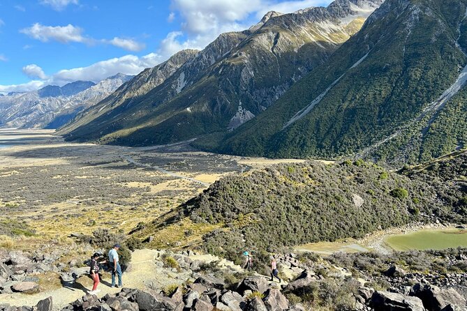
Lake Pukaki isn’t treated as a one-time photo stop. You see it during the helicopter ride, then you see it again from the hiking length. That repetition is valuable because the lake changes with angle, light, and distance.
As you hike, you’ll also catch views of the Tasman River Delta. This is the kind of scenery that rewards slow attention. From one spot you may see the lake’s bright tones; from another, the surrounding waterways and where the land meets the river system becomes more obvious.
If you’re the type who likes to understand what you’re looking at, this is a good match. Your guide can help you place the views in a larger picture—how the river, lake, and glacier-shaped terrain connect.
Restored historic field station stop: snacks, hot drinks, and real stories
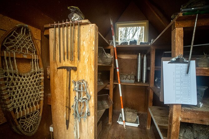
One of the best parts of this tour isn’t a view. It’s the historic field station stop. This is a restored site where you get home-baked snacks and hot tea/coffee/hot chocolate. It’s also the moment where you can slow down, warm up a bit, and recharge before the hike stretches or settles into its final portion.
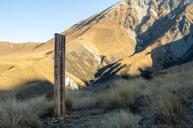
This stop adds texture to the day. Helicopter flights can feel like pure spectacle, but a historic field station brings in the human side—people working in the mountain environment and leaving behind a place you can still visit. It’s a reminder that this region has been studied and traveled for a long time, not just photographed for the last decade.
And yes, the food matters. You’ll likely appreciate it more than you expect after sitting in a helicopter and walking in alpine conditions.
The hike: 4 hours with breaks, flat-ish sections, then more downhill
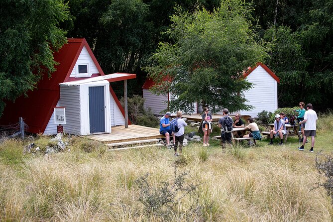
The hike is part of why this tour earns its name. It’s not just a stroll to a single view.
The total experience is about 4 hours, and the hiking portion includes frequent stops for breaks. That’s important because high country walking can feel longer than you expect, even when the terrain is manageable.
From past groups’ feedback, the terrain is relatively flat for about a third of the hike, then shifts into a downhill feel for the rest. That’s useful information for planning your effort. Downhill is often easier for some people and harder for others—knees and quads are the usual concern.
If you’re planning for the hike, I’d prepare for:
- steady walking with breaks
- a mix of flat and downhill sections
- chances to stop for photos and explanations
What’s included vs what you must bring (so you don’t get cold)
This tour takes some of the load off your packing list. Hiking poles are provided, which is a big deal on uneven or slopey ground. You’ll also get sunscreen and insect repellent.
They also provide snacks and hot drinks at the historic field station stop. That’s more than convenience—it helps you keep moving without hunting for food mid-day.
What you must bring is where you should be most careful:
- Proper hiking footwear
- Proper clothing, depending on weather conditions
Because the region’s conditions can shift quickly, your clothing needs to handle wind and cooler air, not just warmth in the sun. Even if the day starts clear, alpine weather can tighten up. Dress so you can add or remove layers without turning it into a chore.
There’s also a weight limit listed as 265 lbs total per passenger. If you’re near that, confirm your fit with the operator before booking.
Value check: is $307.18 worth it?
At $307.18 per person, the price is not low. But the value comes from what you’re buying: a guided small-group experience plus helicopter time plus the hike, with key gear and refreshment included.
Here’s what you’re effectively paying for:
- An aviation component (even though it’s short)
- A guide who can explain terrain, history, and culture in real time
- The logistics of getting you into a high country area without you doing all the driving and navigating
- Included hiking poles and snacks
The helicopter segment is only about 8 minutes, so it doesn’t feel like you’re paying for a long air ride. Instead, it’s used like a tool: orientation, photo angles, and a better sense of the route you’ll later walk.
If you’re already in the Mount Cook area and you want a high-impact experience that fits a half day, this can be a solid use of your time.
Guide Brian and the power of a flexible plan
One reason people come away happy is the way the guide handles questions and changes. A name that comes up often is Brian. Past groups credit Brian with sharing information about terrain, wildlife, and the area’s history and culture, and with being willing to adjust when weather gets tricky.
That matters here because the experience requires good weather. If conditions aren’t right, the tour may be rescheduled or offered a full refund. In the real world, that’s how you protect the experience: no one wants a helicopter day with poor visibility.
If you’re booking this, I’d treat it like weather-aware planning rather than a fixed “must-happen” event. The good outcome is that you’re not left guessing. The structure is set up so the operator can either adapt the timing or make it right if the conditions can’t support the hike safely.
Should you book the Glentanner High Country Heli Hike?
Book it if you want a compact adventure with big payoffs. You’ll get:
- strong viewpoints over Aoraki Mount Cook National Park and Lake Pukaki
- a guided walk in glacier-carved terrain
- a real break at a restored historic field station
- a small group size that makes it easier to talk with your guide
Skip it (or wait and choose another option) if you’re not ready for moderate walking or you don’t have good shoes and layers. Also, if you hate weather uncertainty and need a rigid plan, this tour’s weather dependence may test your patience.
If you match the physical level, show up equipped, and embrace the mountain weather mood swings, this is one of the more efficient ways to experience the Southern Alps—sky views plus a guided hike, without eating your whole day.
FAQ
How long is the Glentanner High Country Heli Hike?
The tour lasts about 4 hours.
What’s included in the tour?
It includes hiking poles, home-baked snacks at the historic field station stop, hot tea/coffee/hot chocolate at the historic field station stop, sunscreen, and insect repellent.
What should I bring?
You should bring proper hiking footwear and proper clothing for the weather conditions.
Where is the meeting point?
The tour meets at 3388 Mount Cook Road, Glentanner 7999, New Zealand, and returns to the same place.
How large is the group?
The tour has a maximum of 15 travelers.
What happens if the weather is poor?
This experience requires good weather. If it’s canceled due to poor weather, you’ll be offered a different date or a full refund.