REVIEW · KAMPALA
Rwenzori Mountains Trekking with Margherita Peak Summit
Book on Viator →Operated by Bujuku Eco Tours & Travel Ltd · Bookable on Viator
Margherita Peak is a serious day on the clouds. This 7-day Rwenzori Mountains trek through Rwenzori Mountains National Park blends rainforest wildlife, slippery ridge paths, and a high, glacier-heavy summit to the Margherita Peak (5,109m) zone. I especially like the pacing with classic hut bases like Nyabitaba and John Matte, and the fact you’re in real mountain habitat where you may hear chimpanzees and spot the colorful Rwenzori turraco. The route’s personality also comes from the mossy bog sections that force you to slow down and pay attention with every step.
The main consideration is that the Margherita climb includes glaciers, ice, and exposed terrain, so you’ll need to think seriously about climbing kit (it’s not included) and accept that the weather can be cold and foggy.
In This Review
- Key things that make this Rwenzori Margherita trek worth it
- Why the Rwenzori Mountains feel different from other African hikes
- First steps from Nyakalengijja: forest, river crossings, and the first ridge climb
- Bamboo, bamboo—then bog: the middle days that test your footing
- Elena Hut to Margherita Peak: the glacier scramble day (5,109m)
- Beyond the summit: passes, mossy highs, and the Bujongolo historical stop
- The finish loop back to Mihunga gate: Kichuchu cliffs and river mud
- Support, organization, and how hut-style trekking feels in practice
- Price and logistics: what $1,400 buys, and what you must bring
- What to pack and how to prepare for cold, mud, and high altitude
- Should you book Margherita Peak with Bujuku Eco Tours?
- FAQ
- How long is the Rwenzori Mountains trek to Margherita Peak?
- What’s the summit height for Margherita Peak?
- What does the price include?
- Is climbing gear included?
- Where does the trek start and end?
- Is this tour private?
- What wildlife might I see on the trek?
Key things that make this Rwenzori Margherita trek worth it
- High-altitude payoff: a summit to Margherita Peak at 5,109m.
- Wildlife-rich forests: along the Mubuku River system, with chances for monkeys and even turraco.
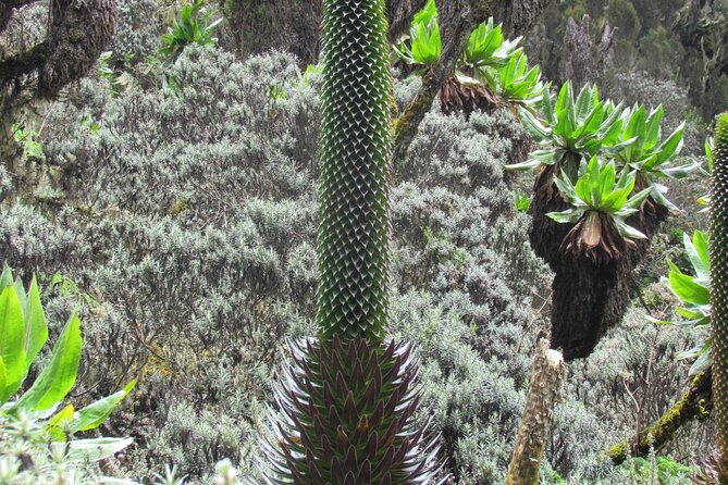
- Bog travel you’ll remember: giant lobelias in Lower Bigo Bog, with chilly, squishy footing.
- Real alpine scenery: giant heathers, lobelias, groundsel, plus glaciers and the Stanley Plateau.
- Support you can count on: strong guide organization reported by past trekkers, including named staff like Johnson and Geofrey/Geoffrey.
- Food covered for the whole trek: breakfast, lunch, and dinner each day.
Why the Rwenzori Mountains feel different from other African hikes
Most “big mountain” treks focus on views. The Rwenzori often gives you views plus a strange, specific kind of life you won’t see elsewhere. Rwenzori Mountains National Park protects the highest parts of the long Rwenzori range, and the vegetation here is unique to equatorial alpine Africa—think giant heathers, lobelias, groundsel, and lots of species tied to the Albertine Rift.
You’re also hiking in a place with serious ecological variety. The park is home to dozens of mammal species and many birds, including Albertine Rift endemics. On this trek, that matters because you don’t just walk past scenery—you move through habitat zones, from thick forest near the rivers to high alpine plants above the huts.
And then there’s the contrast of “normal” footpath travel with the summit day. One part of this trek is muddy, mossy, and wet. The next part is ice, glaciers, and exposed scrambling. That’s why Margherita feels like an actual mountaineering goal, not just a long hike.
You can also read our reviews of more tours and experiences in Kampala.
First steps from Nyakalengijja: forest, river crossings, and the first ridge climb
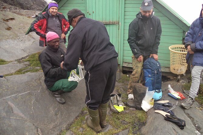
You start with a trip briefing in Nyakalengijja, plus time to organize your equipment before the trail begins. The opening route goes through farmland and then transitions into a thick forest along the Mubuku River. Soon you’ll cross a tributary (the Mahoma River tributary is named), and that’s your first clue that the trek is about travel through a living watershed, not just a dry track.
The first big push is a long, steep climb onto a massive ridge to reach Nyabitaba hut. This is the kind of start that sorts out your pace quickly. If you go out too fast, the steepness will punish you before the trek even finds its rhythm.
Wildlife adds spice early. In the forest sections, you may hear chimpanzees and you might spot black-and-white colobus, blue monkey, and the Rwenzori turraco. Even if you don’t see everything, the point is that the hike is routed through areas where wildlife encounters are plausible, not random luck.
Practical takeaway: plan on 6 to 7 hours for this stage, and treat it like your warm-up hill rather than an “easy day.”
Bamboo, bamboo—then bog: the middle days that test your footing
After Nyabitaba, the trail drops down through forest to Kurt Shafer Bridge just below where the Mubuku and Bujuku rivers meet. You’ll pass through bamboo forest and then move into a long stretch of slippery, moss-covered rock. This is the kind of ground where steady footsteps matter more than speed.
A key moment here is Nyamuleju rock shelter. From there, Mount Stanley and Mount Speke can be visible. It’s not the summit yet, but these sightlines help you understand how big the terrain is and why your later passes and high huts are worth the effort.
Then you move into high-plant country: giant heather, lobelia, and groundsel. Finally, you reach John Matte Hut for dinner and overnight. This is a good “work day” zone—steady climbing, then a firm reset at the hut.
The next stage drops you to cross the Bujuku River and enter Lower Bigo Bog, where giant lobelias grow. Expect to hop from tussock to tussock. The route description doesn’t sugarcoat it: crossing the bog can mean your feet sample some freezing ooze. That’s not just a detail—it’s a reminder that water and cold go together here.
From Lower Bigo Bog you cross into Bujuku Lake, with views that can include Mt Baker to the south and Mt Stanley to the west. You then reach Bujuku Hut tucked in a narrow valley below Stuhlmann Pass, with the mountain shadows around you. This stop is also described as helpful for acclimatization for peak attempts on Mount Stanley and Mount Speke, which tells you the schedule is designed for altitude tolerance, not a single straight shot to the top.
Elena Hut to Margherita Peak: the glacier scramble day (5,109m)
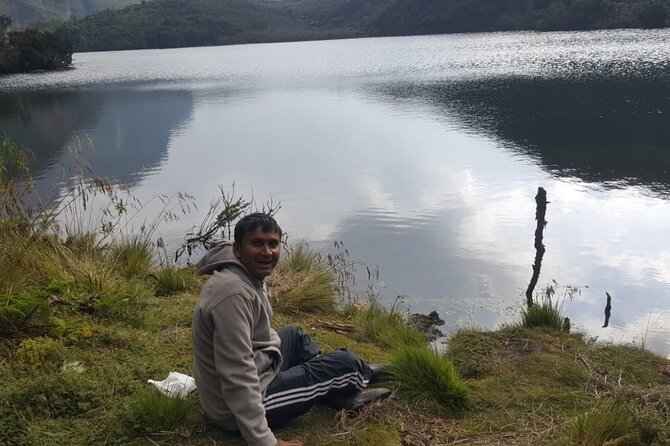
This is the day with the headline name. Early in the morning, you attempt the summit of Margherita, the highest peak of the Rwenzori mountains, at 5,109m. The climb is described as taking about 4 to 5 hours depending on weather and pace.
What makes it mountaineering-style is the terrain. The route to Margherita includes three glaciers, slippery rock, ice, and very exposed areas open on many sides. You cross the Stanley Plateau and then continue the ascent. This isn’t a “follow the trail and you’re done” moment.
Weather is also part of the challenge. The route description explicitly mentions fog, altitude sickness risk, and cool conditions. That’s why this trek’s prior nights and hut stops matter: they’re building time in the mountains before you go after the highest point.
Once you scramble up to the summit, you descend back to Elena Hut. The descent is listed around 2 to 3 hours, which still isn’t “easy,” because going down glaciers and exposed areas can be just as mentally demanding as going up.
How to think about this day: you’re not only climbing height; you’re managing conditions—traction, visibility, and how your body handles cold and altitude.
Beyond the summit: passes, mossy highs, and the Bujongolo historical stop
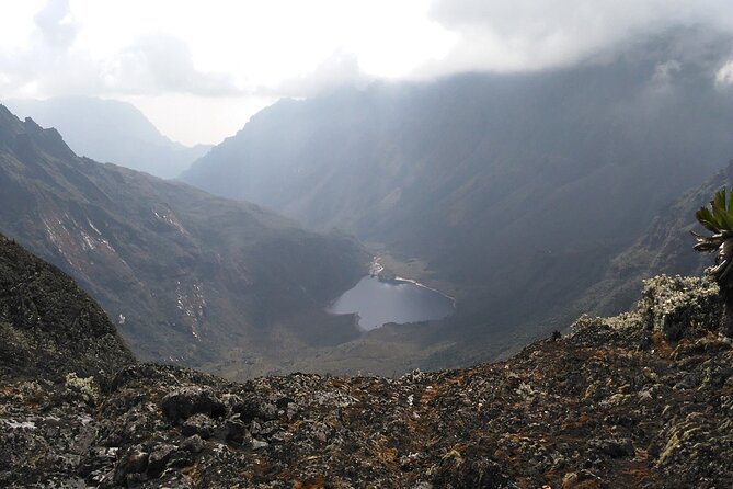
After you return from Margherita and settle back into the trekking flow, the later stages shift toward higher passes and longer terrain transitions. From the Kitandara side, the trail ascends steeply up the headwall, spreading out from the base of Mount Baker. You then continue along the south side of the mountain.
You reach Freshfield Pass at 4,282m, where you can view into the Congo to the west and Mount Stanley to the north. This kind of viewpoint is a reward, but it’s also a navigation and pacing checkpoint: high passes often feel steady until they don’t—so it helps that you’re placed in this part of the trek after the summit has already been handled.
From the pass, you head along a long high alpine mossy section. Then the plan becomes descending steep rocky trails toward Bujongolo, described as a rock shelter. Bujongolo is also named as the base camp for the historic expedition by the Duke of Abruzzi in 1906. That historical link is one of the reasons this stage feels more meaningful than just “more walking.” You’re walking in the same mountain zone where explorers once fought for access and survival.
You then overnight at Guy Yeoman camp, before the final day’s descent.
The finish loop back to Mihunga gate: Kichuchu cliffs and river mud
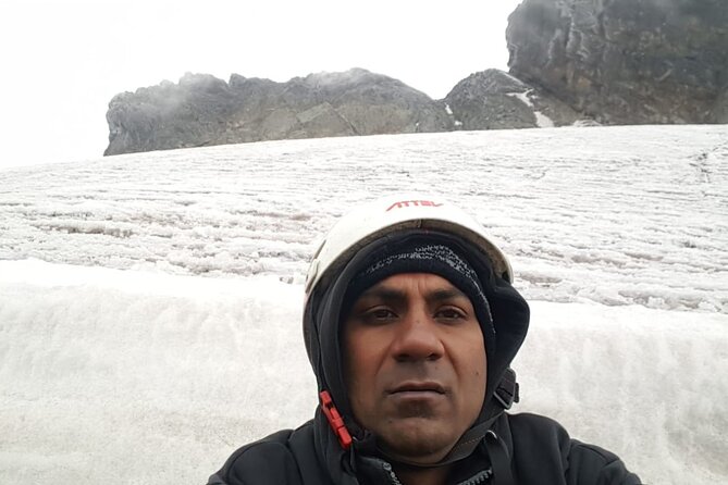
The last stage starts below Guy Yeoman and heads down through the cliffs of Kichuchu. After Kichuchu, the path is muddy and you cross the Mubuku River twice through bamboo forest. Then you climb downwards to Nyabitaba to complete the circuit.
From Nyabitaba camp, you keep descending and finish by evening at Mihunga gate. The key vibe here is that you’re moving out of higher terrain back into the forest corridor, with water and mud likely staying part of your steps right through the end.
When a trek ends like this—still working, still moving, not a “slow stroll”—it helps you feel the full arc of the mountain. You started steep. You moved through forest, bog, and bog again. Then you faced glaciers at altitude. Now you’re paying off the descent.
Support, organization, and how hut-style trekking feels in practice
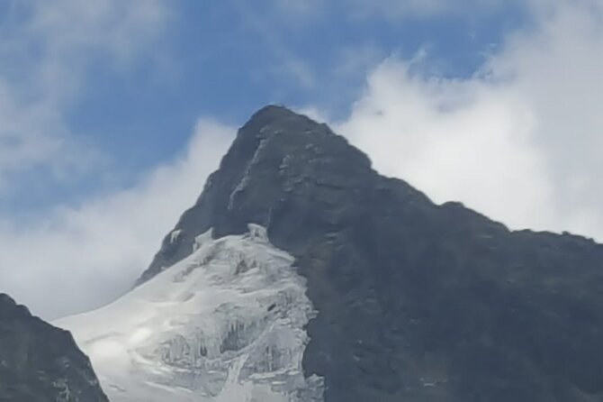
A big reason this trek gets strong marks is support and planning. Past experiences with Bujuku Eco Tours & Travel Ltd are described as reliable and well organized, with friendly, professional guides. Several reviews highlight named staff such as Johnson and Geofrey/Geoffrey, and trekkers mention clear communication and a team that helps with what you need.
That matters on a trek like this, because the mountains don’t run on your schedule. Weather can shift, footing can change fast, and you need the group to keep moving safely. Having a guide who’s efficient and organized reduces stress when conditions aren’t comfortable.
You’re also not doing this as an independent expedition. This is a private tour/activity, meaning it’s only your group. For a summit-focused trek, that can be a real quality-of-life factor—you’re not trying to match a dozen different walking styles on glacier day.
On the food side, the package covers breakfast, lunch, and dinner for 7 days. That doesn’t mean you’ll eat like you’re at a hotel buffet, but it does mean you’re not scrambling for meals in remote hut zones. It’s also a practical value point: hydration and energy management matter a lot at altitude.
Price and logistics: what $1,400 buys, and what you must bring
The price is $1,400 per person for the 7-day trek, with pickup offered. On paper, that sounds straightforward. In the real world of remote mountain travel, you should judge it on what’s included versus what you’d otherwise have to arrange yourself.
Here, your meals are included for the full trek: 7 breakfasts, 7 lunches, and 7 dinners. Park admission is listed as free in the itinerary notes. That helps your overall cost picture.
What’s not included is climbing gear. That’s the big line item you need to handle. Since the Margherita route includes glaciers and ice and exposed sections, “climbing gear” isn’t a small add-on—it’s central to safety and comfort. Before you pay, you’ll want to confirm exactly what counts as climbing gear and what you’re expected to bring.
Also note that the tour meeting point is Entebbe Airport in Entebbe, and the experience ends back at the meeting point. So you’re not just buying the mountain days—you’re buying the connection back to your entry point in Uganda.
Finally, the trek is described for travelers with moderate physical fitness. That doesn’t mean it’s gentle; it means it’s built for people who can hike long days and handle cold, slippery terrain with a guide system.
What to pack and how to prepare for cold, mud, and high altitude
This trek repeatedly references cold and wet conditions. You cross moss-covered rocks that can be slippery. You enter bogs where feet can get soaked. Elena Hut is described as cool and icy during the summit lead-in.
So you’ll want to pack for damp cold, not dry-cold only. Expect that your body will get chilled during breaks and on exposed segments. A good strategy is layering you can adjust while hiking, then adding warmth as you stop.
You should also assume that your summit-day comfort depends on weather and visibility. Fog is explicitly mentioned. When fog and cold combine with exposed terrain, movement slows and careful pacing matters. The trek’s structure gives you time in the mountains before summit day, but your own pacing still controls how you feel.
And yes, plan for gear. Since climbing gear is not included, start thinking early about what you’ll carry and how you’ll pack it. Glacier-heavy days are unforgiving if you’re missing the essentials.
Should you book Margherita Peak with Bujuku Eco Tours?
Book this trek if you want a true Rwenzori mountaineering experience, not just a scenic walk. The Margherita summit (5,109m) is the reason people come, and the route is built around the reality of glaciers, ice, and exposed sections. I also like that the trek is positioned through different habitats—forest wildlife zones, bamboo forest, bog with giant lobelias, and high alpine plants—so the journey feels like more than one dramatic day.
Skip or rethink if you aren’t comfortable with cold, wet footing, and the idea of exposed glacier travel. Also, treat the included/not-included split seriously: climbing gear isn’t covered, and summit day depends on you having what you need.
If your goal is a well-run, private group trek with solid communication and strong guide support (including staff like Johnson and Geofrey/Geoffrey mentioned in past experiences), this is a strong value way to aim for Margherita Peak.
FAQ
How long is the Rwenzori Mountains trek to Margherita Peak?
It’s listed as 7 days approximately.
What’s the summit height for Margherita Peak?
Margherita Peak on this trek is 5,109m asl.
What does the price include?
The tour includes breakfast, lunch, and dinner for 7 days, and pickup is offered. Park admission is shown as free in the itinerary notes.
Is climbing gear included?
No. Climbing gear is not included.
Where does the trek start and end?
It starts at Entebbe Airport (Entebbe Uganda) and ends back at the same meeting point.
Is this tour private?
Yes. It’s a private tour/activity, meaning only your group participates.
What wildlife might I see on the trek?
On the forest sections you may hear chimpanzees and may spot black-and-white colobus and blue monkey. The Rwenzori turraco is specifically mentioned, and chameleon is also mentioned in trek experiences.