REVIEW · HILO
Hilo: Elite Volcano Hike
Book on GetYourGuide →Operated by KapohoKine Adventures · Bookable on GetYourGuide
Lava rewrote the road, and you walk it. I loved the 2018 eruption sites on the Puna Coast and inside Hawaii Volcanoes National Park, and I liked the small-group setup that keeps your guide close for real explanations. The trade-off is that this is a long, hot day with uneven volcanic ground, so it’s not a good match if you have back issues or breathing problems.
You start with hotel pickup in Hilo and a full itinerary that goes from lava flows to viewpoints and ends at a crater you can really stand in front of. You’ll have lunch at Isaac Hale Beach Park (weather permitting), then you’ll spend time hiking in the caldera area, with a chance to spot native birds like yellow ‘amakihi and red ‘apapane. Plan on bringing closed-toe shoes and treating this like a hike, not a stroll.
In This Review
- Key highlights worth caring about
- From Hilo to the Puna Coast: why this route feels different
- Mackenzie State Recreation Area: walking the lava-blocked highway
- Isaac Hale Beach Park and Fissure 8: the eruption meets neighborhood roads
- Hawaii Volcanoes National Park: from Kilauea Iki Overlook to Keanakakoi
- Inside the caldera: rock slide evidence and Halema’uma’u’s 1,000-foot-deep pit
- Birds and boulders: finding ‘amakihi and ‘apapane while you hike
- The guide experience: clear explanations, humor, and local stories
- How tough is the Elite Volcano Hike, really?
- What you get for $189: value beyond the price tag
- Who should book this, and who should skip it?
- Should you book the Elite Volcano Hike?
- FAQ
- How long is the Elite Volcano Hike?
- Where do I meet for hotel pickup in Hilo?
- How big is the group, and is there a guide?
- What eruption and park sights are included?
- How much hiking happens in Hawaii Volcanoes National Park?
- Is lunch included on the tour?
- What footwear do I need?
- Who is this tour not suitable for?
Key highlights worth caring about
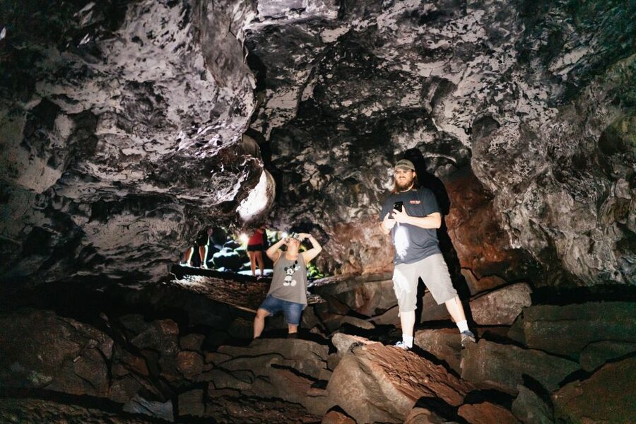
- 2018 eruption firsthand: see lava-driven changes at multiple stops, not just a single overlook
- Walk the lava-blocked route: hike parts of a now-closed highway at Mackenzie State Recreation Area
- Fissure 8 on the drive: get close to the spot tied to the Lelani Estate eruption scene
- Kilauea Iki Overlook to Keanakakoi: a guided descent that leads to caldera views and 2018 damage
- Halema’uma’u Crater scale: understand the eruption’s impact at the edge of a huge pit
- Birdwatching during the hike: look for yellow ‘amakihi and red ‘apapane along the way
From Hilo to the Puna Coast: why this route feels different
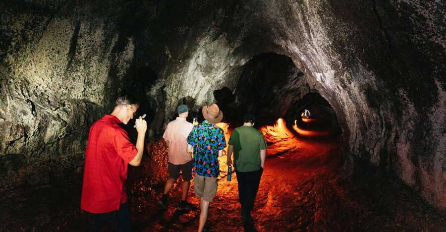
This is a true “whole day” Hawaii Volcanoes-style tour. You’re not just driving through the big-name national park. You’re also getting out toward the Puna Coast, where the 2018 eruption changed roads, coastlines, and the look of the shoreline. That context makes the later caldera hike hit harder, because you’ve already seen how fast the island can redraw itself.
The pace is intentionally full: a lot of the day is spent traveling between sites, and then the walking comes in focused chunks. In practice, that means you’ll be sitting in the van enough to rest your legs, then stepping out when the guide cues you for the next scene and story.
Also, you’ll want to remember this: the day is long. Even when the hiking is relatively short (and there’s a paved road segment inside the park), you’ll still be outside for hours in Hawaiian heat. The tour is built for seeing more than one eruption-related location, so plan your energy accordingly.
You can also read our reviews of more tours and experiences in Hilo.

Mackenzie State Recreation Area: walking the lava-blocked highway
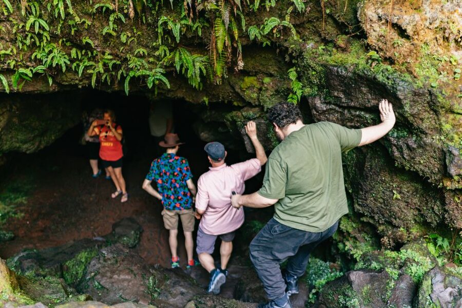
Your first major stop is the Mackenzie State Recreation Area on the Puna Coast. This is where you start connecting what you see on the ground to what happened in 2018—because the tour begins at the edge of that disruption. You’ll head out from Hilo, then arrive at the area where the highway was closed by a wall of crumbly a’a lava pushing toward the sea.
From there, you’ll hike along the now-closed highway. That part matters more than it sounds. Walking a road that no longer exists the same way makes the eruption feel physical, not abstract. You’re literally tracing the boundary between what used to be passable and what became permanently altered.
The route then continues through a pine forest and toward an altered coastline. You’ll reach cliffs overlooking a new black sand beach, which gives you a striking visual contrast: jagged volcanic ground, then the dark sand where fresh volcanic material met the ocean. If you enjoy geology that you can see, not just read about, this is one of the most rewarding sections of the day.
A practical note: this area is all about footing. The ground can be uneven and volcanic, so keep your closed-toe shoes snug and ready. This is not the time for anything that slips or offers poor grip.
Isaac Hale Beach Park and Fissure 8: the eruption meets neighborhood roads
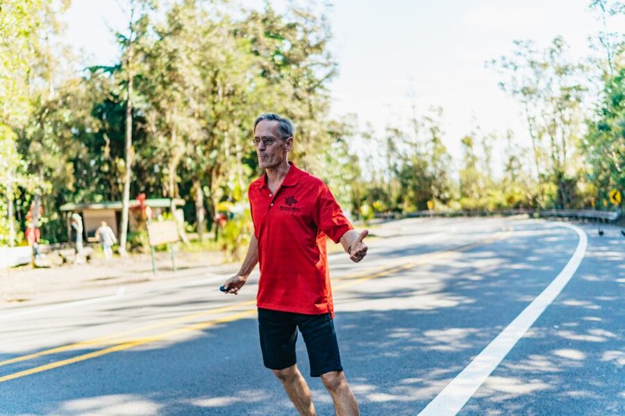
Next up is Isaac Hale Beach Park. Here, you’ll drive along what’s known as Fissure 8—an eruption point tied to the heart of a Lelani Estate subdivision. It’s one thing to hear about lava entering populated areas. It’s another to roll past the stretch and let the scale of the event sink in while you’re still in the middle of a regular day’s tour.
This stop is also where the itinerary slows a bit. You’ll have a picnic-style lunch served at the park, weather permitting. That’s a big deal for a day like this, because heat and sun can stack up fast once you’re past the morning drive.
If you like tours that balance big drama with normal human rhythms, this stop works. You’re eating in a place shaped by a real eruption, but you’re still doing the basics: taking a break, refueling, and watching the coastline change in real time.
Hawaii Volcanoes National Park: from Kilauea Iki Overlook to Keanakakoi
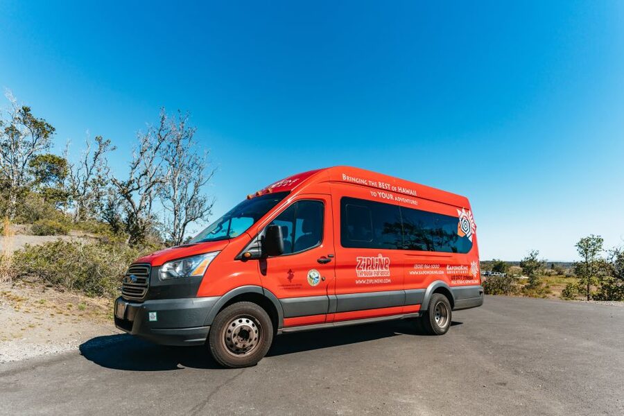
After the Puna Coast portion, you’ll head for the crown jewel: Hawaii Volcanoes National Park. This is where the scenery and the stories start stacking together—because by the time you arrive, you’ve already seen the eruption’s aftermath on the coast and near roads.
The day begins here with a brief visit to the Kilauea Iki Overlook. It’s a quick orientation moment. From there, you head down on foot via a paved road to Keanakakoi, which is important because it makes the hike feel less punishing while still putting you in the right spot to understand what happened in 2018.
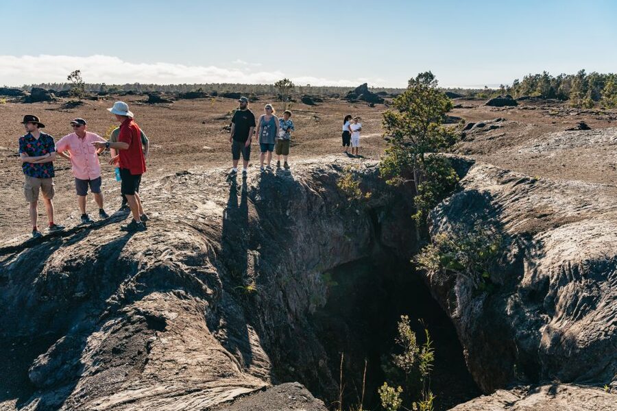
At Keanakakoi, you’ll check out activity from that 2018 eruption. The road buckled, and the ground shows sinkholes and other signs of movement. The guide’s job is to connect what you’re seeing—those altered sections and marks on the ground—with the eruption’s behavior, so the damage doesn’t just look like random chaos.
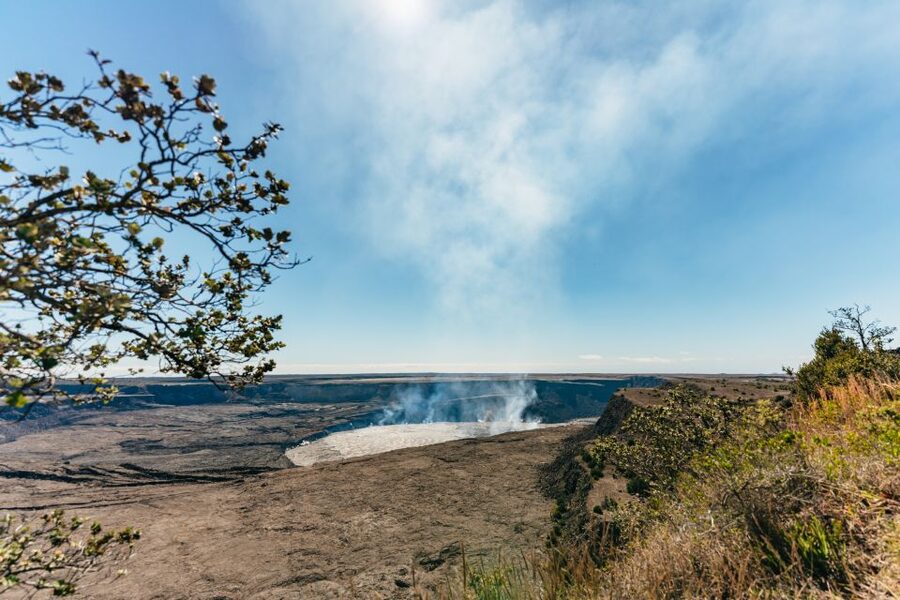
This is also a viewpoint-rich area. You’ll get birds-eye views of the Kilauea Caldera and the enormous Halema’uma’u Crater. Even before you reach the caldera floor, you’ll be seeing the trail you’ll take next, so it feels like you’re walking with a map in your head instead of just following footsteps.
Inside the caldera: rock slide evidence and Halema’uma’u’s 1,000-foot-deep pit
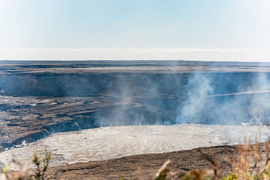
Once you reach the floor of Kilauea Caldera, the tour takes on a quieter intensity. The visuals become more about scale and cause-and-effect than about dramatic road damage.
To your left, you’ll notice a rock slide that serves as evidence of the 2018 eruption. It’s one of those natural reminders that volcanoes don’t just erupt—they also rearrange slopes and stability. Standing there, you get a better sense of how much force is involved, even long after the loud part has passed.
Ahead of you sits Halema’uma’u Crater. During the 2018 eruption, the crater increased in size. The lava lake then drained, leaving behind an enormous pit roughly 1,000 feet deep. That detail matters because it turns a single name on a map into a physical reality you can point at and look across. You’re not just “seeing a crater.” You’re seeing the shape left behind when the system changed.
You’ll also be walking along the 2-mile stretch in this area, with the trail leading you back to the starting point after you’ve taken in the views. The good part of doing this with a guide is that you don’t have to guess what each feature is or why it’s there. You can just focus on the hike and the drama of the caldera.
Birds and boulders: finding ‘amakihi and ‘apapane while you hike
One of the smarter touches on this itinerary is the bird component. Throughout the 2-mile caldera hike, you can look for native birds such as the yellow ‘amakihi and the red ‘apapane. That gives you a reason to slow down your own pace and scan the area with your eyes higher than the ground.
It also changes the feel of the hike. Volcanic sites can become all about rocks and nothing else. Adding birds gives you a living note—one more reminder that this environment isn’t frozen history. It’s still active and full of life.
The hike also includes stops where the ground carries older stories. Huge boulders came to rest at this location during ancient rock slides and eruptions. You can look for marks left by previous visitors such as Benjamin Boyd and John Webster. That’s a nice contrast to the modern 2018 evidence you’ll be seeing elsewhere on the route. You end up with a timeline you can feel: older movements, then the recent eruption, then the ongoing recovery.
The guide experience: clear explanations, humor, and local stories
The tour’s success hinges on the guide, and this one tends to shine there. You’ll have a live tour guide in English, and the group size is limited to 13 participants, which makes a big difference. With a smaller group, your guide can answer questions without feeling rushed, and you spend less time stuck waiting while others catch up.
In particular, guides like Ray have been praised for strong explanations and a dynamic style with humor that keeps the group engaged. Another guide named Nick has been noted for being very informative and for sharing local experiences about the island and volcanos.
That matters because volcano sites can overwhelm you with detail. A good guide helps you pick up the main threads: what changed, what it means, and how to look at the ground so you understand it instead of just staring at it.
Even the driving segments benefit. When your guide is speaking clearly, the van ride stops feeling like dead time and starts acting like prep for the next stop—especially when you’re moving between very different parts of the eruption zone.
How tough is the Elite Volcano Hike, really?
This is not an all-flat nature walk. You’ll be outside for much of the day, and at multiple points you’ll be on uneven volcanic ground. The park segment includes a paved road descent to Keanakakoi and then a 2-mile hike in the caldera area, which helps. But the earlier Puna Coast hiking and the lava terrain details still make it more active than a viewpoint-only tour.
Heat is a real factor. One of the most direct notes from past visitors is that the day can be tough in the heat, even if the payoff is worth it. If you’re sensitive to sun and heat, plan to pace yourself and listen to the guide’s timing.
On the flip side, the tour also seems to work well for older, less able people—mainly because the caldera hike is set up as a manageable distance and the early navigation includes guided stops rather than long stretches of off-trail scrambling. That doesn’t mean it’s easy. It means the route is designed to be accessible enough for a range of abilities, as long as you can handle standing, walking on volcanic surfaces, and a long day.
Important limits are explicit. This tour is not suitable for pregnant women, people with back problems, wheelchair users, or people with respiratory issues. If any of those apply, it’s best to choose a different volcano option that matches your needs.
What you get for $189: value beyond the price tag
At $189 per person, you’re paying for a full-day structure with a lot packed into it. What makes the price feel reasonable is what’s included: hotel pickup and drop-off, lunch, and beverages, plus a live English guide and the small-group limit of 13 people.
The pickup alone is a big value in Hilo. You don’t have to figure out timing, navigation, and parking across multiple eruption-related stops. You just meet up, hop in, and let the route do the work.
Lunch at Isaac Hale Beach Park (weather permitting) is another quiet money-saver. This is a day where buying food on the fly could eat up time and energy. Having it built into the itinerary keeps you on track for the park portion later.
The biggest “value” piece is the combination of locations. You cover both Puna Coast eruption sites—where roads and coastlines were changed—and the caldera-and-crater viewing at Hawaii Volcanoes National Park. That connection makes the day feel coherent instead of like a collection of unrelated stops.
Also, free cancellation is available up to 24 hours in advance for a full refund, and there’s a reserve now & pay later option that lets you book without paying today. That reduces risk if your schedule in Hilo is still in flux.
Who should book this, and who should skip it?
Book this tour if you want more than a single national-park viewpoint. You’ll get a guided walkthrough of 2018 eruption impacts across the coast and inside Kilauea’s caldera, with time at Halema’uma’u Crater and a guided 2-mile hike. You also want a small-group vibe where the guide can keep explanations flowing—especially if you like when the story includes humor and clear, practical context.
Skip it if you can’t handle uneven ground, if heat is a major problem for your body, or if the health limits apply (pregnancy, back issues, respiratory issues, or wheelchair use). This isn’t written as an accessibility tour, and it’s better to match your needs to a different option.
Should you book the Elite Volcano Hike?
Yes—if your ideal Big Island day includes hands-on eruption aftermath, a guided hike that mixes views and crater scale, and a full day of stops that connect the Puna Coast to Hawaii Volcanoes National Park. The price makes sense because pickup, lunch, beverages, and expert-led interpretation are bundled together, and the small-group size helps keep the experience personal.
If you’re on the fence, ask yourself one question: do you want to understand the 2018 eruption by walking to the evidence? If the answer is yes, this tour is built for you. If you want an easier day with minimal walking and fewer changes in terrain, look for a less hiking-focused option instead.
FAQ
How long is the Elite Volcano Hike?
The tour duration is listed as 510 minutes, so you should plan for a full day out of Hilo.
Where do I meet for hotel pickup in Hilo?
You can meet at the KapohoKine Adventures store in the Grand Naniloa Resort, 93 Banyan Dr, Hilo, HI 96720. You can also contact them at 808-964-1000 to share your location for pickup.
How big is the group, and is there a guide?
It’s a small group limited to 13 participants, with a live tour guide who speaks English.
What eruption and park sights are included?
The route includes stops connected to the 2018 eruption, hiking in Hawaii Volcanoes National Park, and viewpoints around Kilauea and Halema’uma’u Crater.
How much hiking happens in Hawaii Volcanoes National Park?
You’ll have a hike on foot that includes a 2-mile stretch in the caldera area, plus a descent from the Kilauea Iki Overlook area down to Keanakakoi.
Is lunch included on the tour?
Yes. A picnic-style lunch is included and is served at Isaac Hale Beach Park weather permitting.
What footwear do I need?
Closed-toe shoes are required. Open-toed shoes are not allowed.
Who is this tour not suitable for?
It’s not suitable for pregnant women, people with back problems, wheelchair users, or people with respiratory issues.