REVIEW · REYKJAVIK
Reykjavík: Volcano Eruption Site and Reykjanes Hiking Tour
Book on GetYourGuide →Operated by BusTravel Iceland · Bookable on GetYourGuide
Volcano drama starts with a steady hike. From Reykjavik, you head to the Reykjanes Peninsula to see fresh eruption terrain at Geldingadalur and then finish with the Bridge Between Continents, literally walking a rift between tectonic plates.
I love how this day mixes up-close geology with classic Iceland coastal mood. Lake Kleifarvatn delivers black-sand beach views and geothermal activity cues, and Gunnuhver Hot Springs feels alive with bubbling mud pots and hissing steam vents.
One consideration: the main hike to the eruption viewing area is moderate to hard, around 2 hours each way, and the exact route may change based on conditions and what looks safest.
In This Review
- Key things to look forward to
- Reykjanes Peninsula: where Iceland keeps changing its mind
- Your 9-hour game plan from Reykjavik
- Lake Kleifarvatn and the black beach with geothermal hints
- Seltún Geothermal Area: the quick teaser before the big hike
- The hike to the eruption areas near Meradalir and Fagradalsfjall
- Gunnuhver Hot Springs: mud pots and steam that smell like real work
- Reykjanes Lighthouse: sea cliffs, sea stacks, and salt air
- The Bridge Between Continents: a 15-meter tectonic walk
- Guide quality and safety choices you feel during the day
- Price and value: is $126 worth it?
- What to pack and how to handle Reykjanes weather
- Who should book this tour (and who should skip)
- Should you book this Reykjanes Volcano and Tectonics tour?
- FAQ
- How long is the Reykjanes Volcano eruption site and hiking tour?
- How long is the hike to the eruption viewing area?
- How difficult is the hike?
- Are food and drinks included?
- What should I bring for the hike?
- Is a headlamp included?
- Is pickup available from Reykjavik?
- Where does pickup typically start?
- Is the tour in English?
- Is the tour suitable for children or mobility impairments?
Key things to look forward to
- Litli-Hrutur eruption terrain when the lava flow is paused
- Lake Kleifarvatn black beach plus geothermal activity nearby
- Gunnuhver Hot Springs: steam vents, bubbling mud, and raw geothermal energy
- Reykjanes Lighthouse cliffs and sea stacks with Atlantic wind in your face
- A 15-meter footbridge crossing the Eurasian–American plate boundary
Reykjanes Peninsula: where Iceland keeps changing its mind
If you want Iceland without the usual postcard loop, this is a strong pick. The Reykjanes Peninsula is tied to ongoing tectonic movement, so you don’t just see “old volcano country.” You see a system that still makes noise in steam, hot ground, and shifting lava fields.
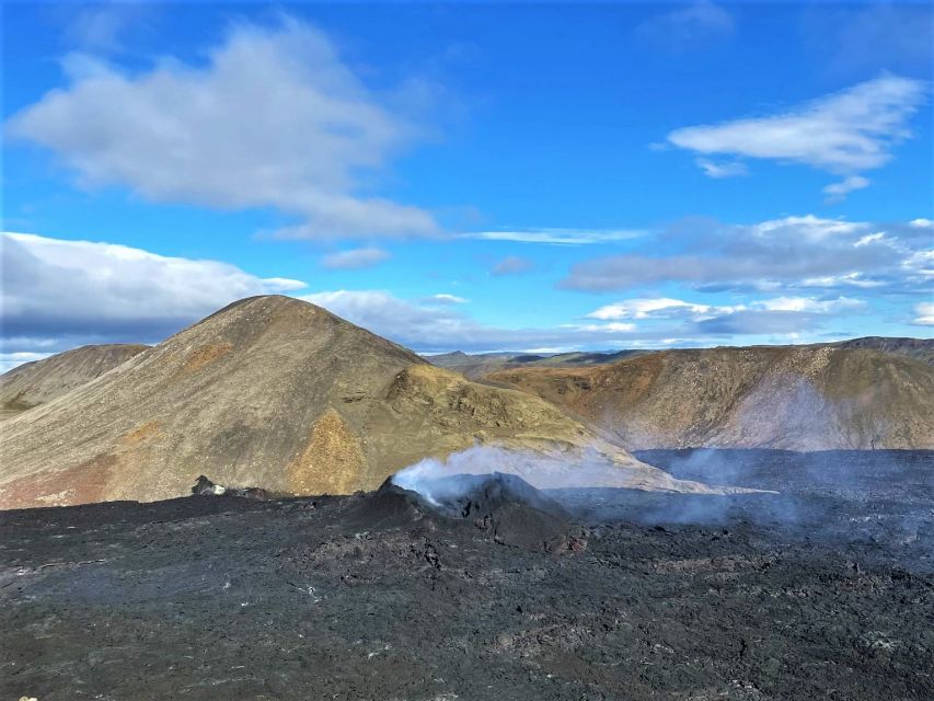
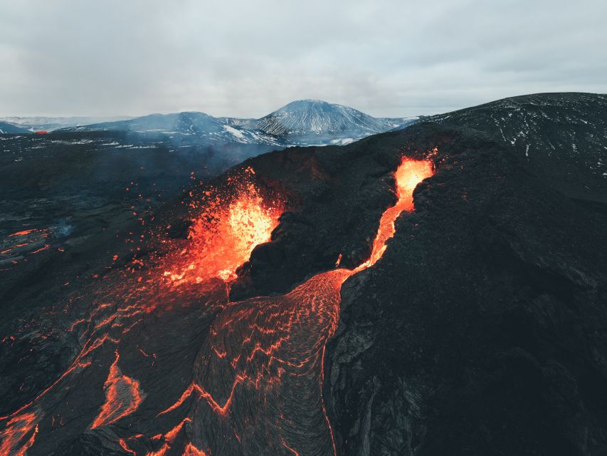
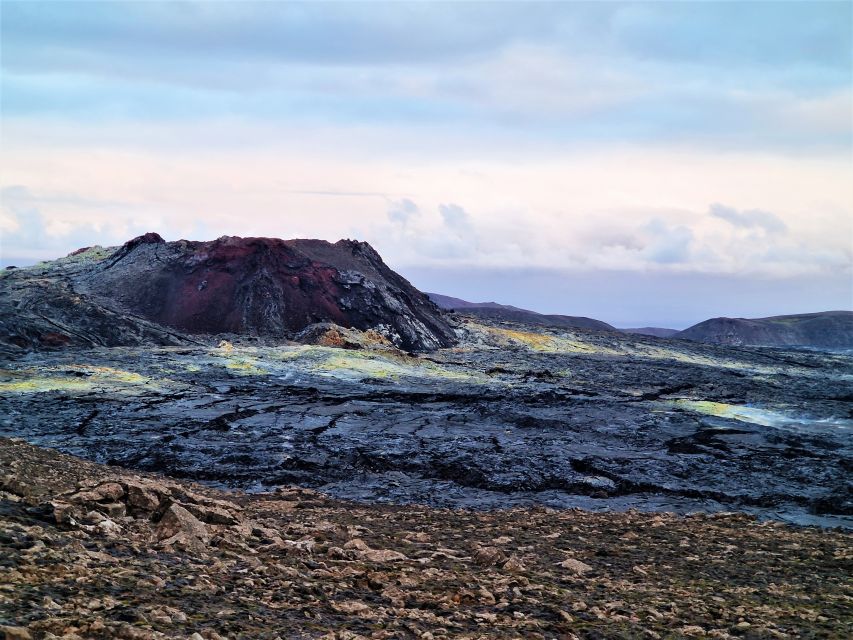
The tour centers on the recent activity around Geldingadalur Valley and the Litli-Hrutur eruption area. Even with the note that the flow of new lava has stopped (at least for the time being), the ground can still look and feel recently disturbed—smoldering, textured, and fascinating in a very real way.
You also get context fast. Guides tend to explain not just what you’re looking at, but how Iceland’s plates and volcanic systems keep reshaping the same coastline again and again. And if you get a guide like Roman, HBO, Ottar, or Omar (names you might hear on this kind of trip), expect the geology talk to come with real storytelling and humor, not just facts on repeat.
You can also read our reviews of more tours and experiences in Reykjavik.
Your 9-hour game plan from Reykjavik
This is a full day, but it doesn’t feel rushed in the way some day trips do. You start with pickup in central Reykjavik (often from bus stop #12, with other options depending on where you’re staying), then you drive out to the Reykjanes area.
Along the way, you’ll get multiple short stops, not just one big “go look at a thing” moment. There’s time set aside for photos at Lake Kleifarvatn, brief sightseeing at geothermal areas like Seltún, and then the longer block for hiking in the volcanic zone.
A bus day can feel bouncy, and the roads around the peninsula are part of the experience. Still, the schedule is built so you’re not trapped on the coach the whole time—when you’re moving, it’s to reach a new pocket of geology or coastline.
Lake Kleifarvatn and the black beach with geothermal hints
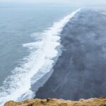
Lake Kleifarvatn is one of those stops where the visuals do half the explanation for you. The black sand beach sits next to the lake, and the area is tied to geothermal activity, including underwater hot springs. The effect is simple but striking: water, dark sand, and mountain silhouettes that make the heat feel even more intense.
I like that this stop works for every travel style. If you want photos, you’ll get them. If you want a quick breather before the hike, you can use that viewpoint time to reset and plan your pace.
Drawback? It’s a short stop, so don’t expect a long walk. This is a photo-and-look-around stop designed to get you ready for the main hiking block.
Seltún Geothermal Area: the quick teaser before the big hike
Right after the lake, the day usually includes a quick run through Seltún Geothermal Area. Think steam, sulfur smells, and active geothermal landforms. This stop is brief, but it’s useful because it sets your brain up for what you’ll see later around the eruption terrain.
When you’re about to hike volcanic ground, it helps to understand what “normal” geothermal looks like there. This stop gives you that baseline before you reach areas that look fractured, dark, and freshly altered by volcanic forces.
The hike to the eruption areas near Meradalir and Fagradalsfjall
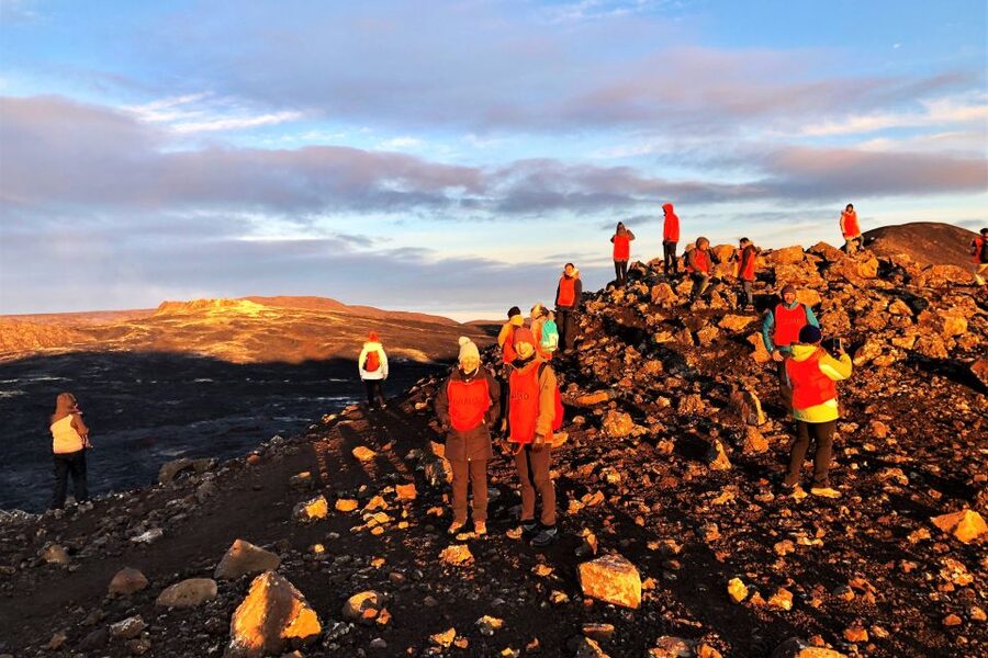
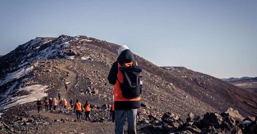
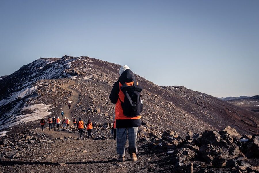
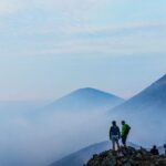
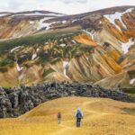
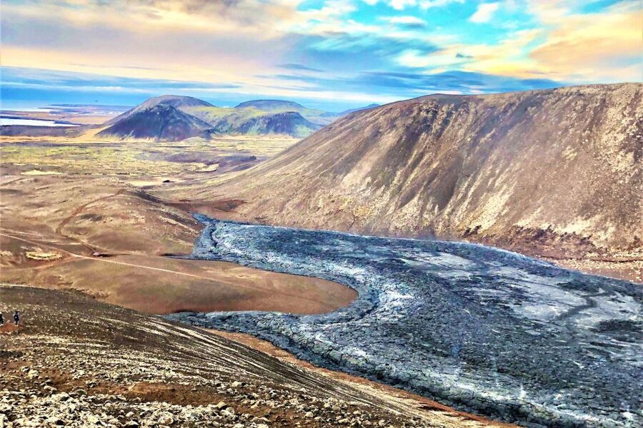
This is the heart of the tour. The hiking portion heads toward the recent eruption viewing zone near places like Meradalir and the broader Fagradalsfjall area, and from there you push on toward the Litli-Hrutur direction (north of Meradalir).
Expect moderate to hard terrain and about 2 hours each way. That’s a real chunk of your day, and the effort matters for your comfort. It’s doable if you’re in reasonable shape, but you should come prepared for uneven ground, wind exposure, and changing traction.
One thing I really appreciate in how this is run: the route can vary day to day. The guide’s job includes taking you to the safest viewing point rather than forcing everyone down the same line no matter what the weather and conditions say.
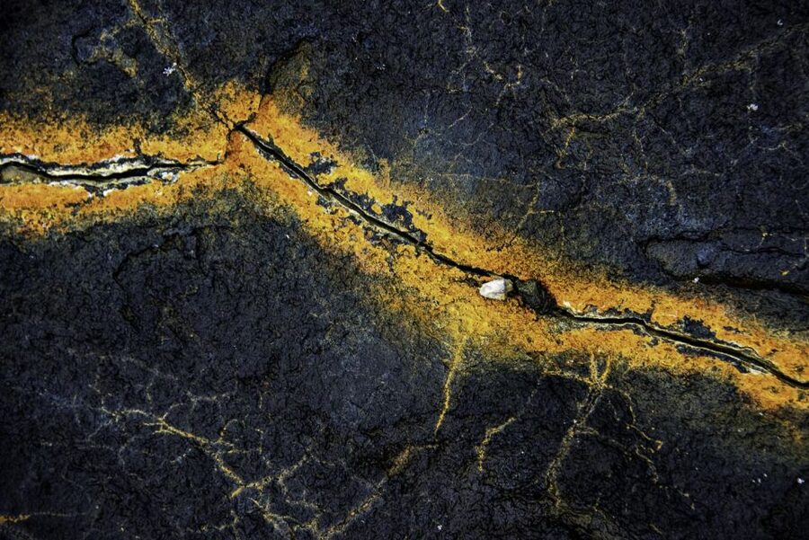
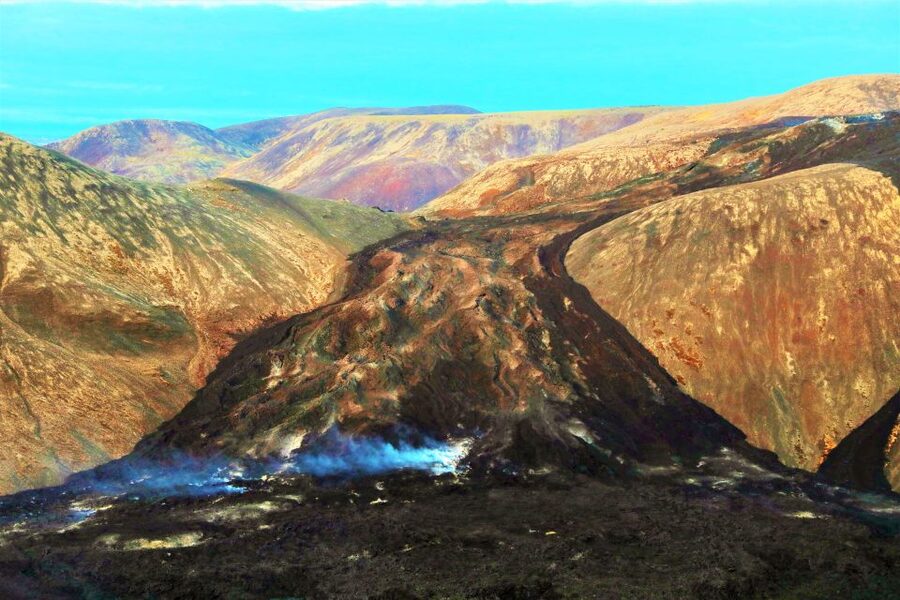
If you’re lucky, you’ll see signs connected to recent volcanic activity. Some groups have described sights like lava formations close to where people live, and even lava that looks newly set or still reacting from time to time. Even when the most dramatic flow isn’t happening, the texture of the lava fields and how the ground fractures and cools can still be astonishing.
Practical tip: eat before you head out if you can. There’s usually a good moment to use packed lunch time during the hike transition window so you’re not trying to solve hunger mid-stress.
Gunnuhver Hot Springs: mud pots and steam that smell like real work
Gunnuhver Hot Springs is pure geothermal theater. You’ll see bubbling mud pots and hissing steam vents—signs that this heat isn’t just decorative. It’s active, loud in your senses, and unmistakably volcanic.
I like that this stop breaks up the day right after the harder hiking block. It gives you a different kind of experience: less walking, more observing. You can let your camera rest while you watch steam drift and ground settle into its own patterns.
Also, be ready for the smell. Iceland geothermal isn’t perfume. If you’ve ever stood near a strong sulfur area, you know the vibe—briefly unpleasant for some, totally normal for most.
Reykjanes Lighthouse: sea cliffs, sea stacks, and salt air
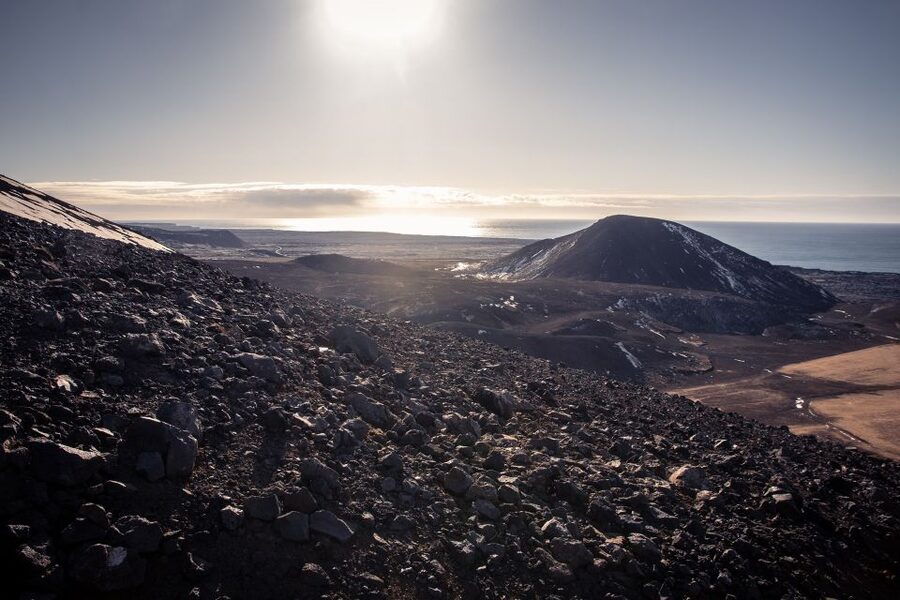
After geothermal chaos, Reykjanes Lighthouse brings you back to the coast. You’ll get photo time and sightseeing with the Atlantic right there. The tour includes the Reykjanes Lighthouse (noted as the oldest lighthouse in Iceland), with views of cliffs and sea stacks shaped by the ocean.
This is where I notice how much the peninsula’s volcanic history ties into the shoreline. The rock forms feel less like random rocks and more like carved evidence—what the ocean did to volcanic material, and how the coastline evolved as the land cooled and broke.
It’s a nice contrast if you’re tired from the hike. You’re standing still, breathing salt air, and letting the dramatic scale sink in.
The Bridge Between Continents: a 15-meter tectonic walk
Then comes the stop people talk about when they want a memorable “wait, that’s real” moment. The Bridge Between Continents crosses a rift between the Eurasian and North American tectonic plates, with a 15-meter footbridge that lets you walk over the boundary line.
You don’t need a science degree to get the meaning of this. It’s a simple action—walk across—and it turns abstract plate tectonics into something physical under your feet. Guides often add a quick explanation of why the rift exists and how the region’s volcanism links back to plate movement.
Photo tip: plan to shoot first, then walk. The best “I’m actually there” pictures come when you’re not distracted by stopping and starting mid-bridge.
Guide quality and safety choices you feel during the day
The guide makes a big difference here. In the best cases, you get someone with strong geology skills plus a practical safety mindset—especially since eruption areas can change quickly and weather can turn serious fast.
You’ll see it in small decisions: whether you go closer or stay farther back, how the group moves together, and how the hike route adapts when conditions look tricky. The tour description also notes that a headlamp may be provided if required, which signals you should expect some readiness for rough conditions.
From guide names showing up in experiences like Roman, HBO, Ottar, Omar, and Elias, there’s a pattern: guides tend to be friendly, funny, and passionate about connecting the dots for you. That matters because eruption country can look like “cool rocks” until someone gives you a framework for what you’re actually seeing.
Price and value: is $126 worth it?
At around $126 per person for a 9-hour day, the value is mostly in two things you can’t easily replicate yourself without effort: (1) safe route planning in active volcanic areas, and (2) a tight schedule that stacks multiple high-demand stops in one go.
Self-driving can be cheaper in some scenarios, but you’ll still need to solve navigation, weather timing, and the hiking viewing-point question. Here, the guide handles those choices, and you get the coaching to keep the day moving without wasting daylight.
You also get onboard WiFi, pickup and drop-off, and a guide in English. Food isn’t included, so you’ll need a packed lunch, but that’s fairly standard for Iceland hikes. When you price in the time saved and the hassle reduction, this can feel like a fair deal rather than a luxury add-on.
What to pack and how to handle Reykjanes weather
This region can throw wind and rain at you without warning. Dress for that reality. Bring rain gear, water, and packed lunch, plus hiking shoes (comfortable shoes for the non-hike parts are fine too, but your main footwear should handle uneven ground).
Avoid jeans if you can. The tour guidance specifically calls that out, and it makes sense: you’ll want something that won’t get miserable when you’re wet, windy, or trudging over rough surfaces.
If weather is icy, expect the hike to be tougher. One group described guides helping with extra traction gear under the shoes. Don’t assume every day gets that support, but the takeaway is clear: come prepared for cold-foot reality if you travel in shoulder or winter months.
Also: bring layers. Reykjavik weather can go from calm to sharp fast, and the volcanic hike is exposed.
Who should book this tour (and who should skip)
This tour fits best if you want a hands-on volcanic day and you’re comfortable with a hike that’s moderate to hard. The walking time is around 2 hours each way to reach the eruption viewing area, and while it’s doable for people with reasonable fitness, you shouldn’t treat it like a casual stroll.
It’s not suitable for children under 12, and it’s not designed for people with mobility impairments. If you’re traveling with someone who can’t handle uneven outdoor terrain for extended periods, you’ll likely have a mismatch.
If you love geology, want a real sense of Iceland’s tectonic drama, and you like mixing hiking with classic coastal photo stops, you’ll be in the right place.
Should you book this Reykjanes Volcano and Tectonics tour?
I think you should book it if you want three high-impact experiences in one day: a volcano hike near fresh eruption terrain, geothermal stops with steam and mud pots, and then a finish that turns plate tectonics into a literal walk over a rift.
Don’t book it if you hate hiking for long stretches or you want a fully flat, easy day. The main hike is the commitment, and the weather can make that commitment feel bigger than you expect.
If you go, do it with the right mindset: show up ready, follow your guide’s safety calls, pack a lunch, and give yourself time to watch the ground closely. The best moments here are rarely the rushed ones—they’re the times you stop, look, and realize the Earth is still doing its thing right in front of you.
FAQ
How long is the Reykjanes Volcano eruption site and hiking tour?
It runs for about 9 hours total.
How long is the hike to the eruption viewing area?
The hike is around 2 hours each way.
How difficult is the hike?
It’s moderate to hard. The route can vary depending on conditions, and it’s only done to a safe viewing point.
Are food and drinks included?
No. You’ll need to bring a packed lunch and water.
What should I bring for the hike?
Bring comfortable or hiking shoes, water, rain gear, and a packed lunch.
Is a headlamp included?
A headlamp is included if required.
Is pickup available from Reykjavik?
Yes. Pickup is available from selected hotels, official bus stops in central Reykjavik, and from the cruise port (confirm your pickup details after booking).
Where does pickup typically start?
Pickup is from bus stop #12 in Reykjavik.
Is the tour in English?
Yes, the live tour guide provides English.
Is the tour suitable for children or mobility impairments?
No. It’s not suitable for children under 12, and it’s not suitable for people with mobility impairments.