REVIEW · PRAIA
Hiking: Monte Tchota Natural Park – Pico D’Antónia (1394m) – Longueira
Book on Viator →Operated by Bu Country Tours · Bookable on Viator
Santiago’s highest climb is surprisingly human-scale. In Monte Tchota Natural Park, you work your way up to Pico D’Antónia (1,394m), then come back down through working farmland and mountain homes carved into the Longueira hills.
I love two parts of this outing: the top-of-the-mountain picnic lunch, and the way your guide turns the hike into a living lesson on local plants, birds, and agriculture. With guides like Cátia (and driver Nilton handling the ride), the day stays friendly and calm, with time to ask questions and catch your breath.
One thing to consider: this is a difficult hike on narrow, uneven trails with steep rock sections on the way down. If your fitness isn’t strong, or if the weather is rough, the route can feel more demanding than the numbers suggest.
In This Review
- Key things to know before you go
- Monte Tchota and Pico D’Antónia: what kind of day this really is
- Getting started from Praia: timing and small-group pace
- Monte Tchota Natural Park: endemic plants, birds, and trail reality
- Pico D’Antónia summit: the picnic reward and the view check
- The Longueira descent: agriculture you can taste, houses you can’t ignore
- What you’ll walk each day: distance, elevation, and why it feels hard
- Packing and safety tips that actually matter
- Price and value: is $98.72 worth it?
- Who should book Monte Tchota—and who should skip it
- Should you book this hike?
- FAQ
- What time does the hike start?
- How long is the tour?
- How hard is the route?
- Is pickup available in Praia?
- What is the hiking distance and elevation range?
- Do I need an admission ticket?
- What should I bring for the hike?
- How many people are in the group?
Key things to know before you go
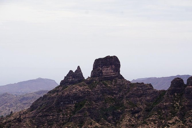
- Highest point on Santiago Island: Pico D’Antónia tops out at 1,394m, and you’ll feel the altitude climb.
- Nature + culture in one walk: endemic plants and birds up top, then real everyday life in Longueira below.
- Picnic lunch on the summit: a real pause with food and views before the descent.
- Weather affects the wow factor: panoramic views (and possible Fogo Island in the distance) depend on clear conditions.
- Small group size: limited to a maximum of 8 people, which helps with pacing.
- Steep, narrow terrain: expect a tilted, narrow path and rocky sections that may feel like light scrambling.
Monte Tchota and Pico D’Antónia: what kind of day this really is
This hike is a good match for people who like physical work, then want the reward to be more than a view photo. You’re moving through natural park trails, but you’re also walking past farmland and mountain homes where people actually live. That mix makes the day feel grounded, not just scenic.
If you enjoy understanding where you are, you’ll like the way the route connects elevation, ecosystems, and farming. At higher altitude you’re looking at endemic plants and birds, then later you’re walking through fields that change with the season—corn, mango, coffee, or tomatoes depending on timing.
The altitude gain is serious enough that you’ll feel it in your legs, and the total walk is around 9 km. Still, it’s guided and structured, so you’re not doing a solo expedition—you’re doing a shared climb with someone who knows where to slow down.
You can also read our reviews of more tours and experiences in Praia.
Getting started from Praia: timing and small-group pace
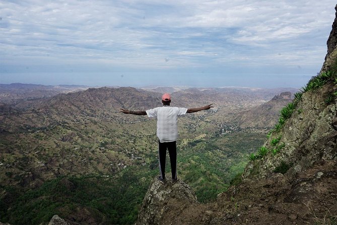
The tour starts in Praia with hotel pickup, and it begins at 8:30 am. That early start matters on this kind of hike because temperatures and light can change fast as you gain elevation, and starting on time helps you keep a steady rhythm.
This is capped at 8 travelers, which makes a difference. In a small group, it’s easier for the guide to manage pace on the steep parts, and it’s simpler to stop when someone needs a breather. The guidance you get tends to be practical—step-by-step help and safety reminders—rather than a long lecture march.
The day runs about 6 hours total, with around 4–5 hours of walking. There’s enough time to do the hike without turning it into a death march, especially if you keep your pace steady and take the scheduled rests seriously.
Monte Tchota Natural Park: endemic plants, birds, and trail reality
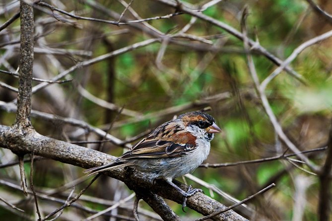
The hike begins inside the Monte Tchota Natural Park, where the focus is on the local ecosystem. You’ll see and learn about endemic plants and birds along the way, so your eyes don’t just scan for a good footing—they also look for species your guide can point out and explain.
One thing I appreciate about this part of the route is that it doesn’t hide the effort. You’ll climb through a natural setting, but the path is described as tilty and narrow, and there are spots where you’ll need level 1 climbing. That means good balance counts, and it’s smart to treat the trail like a slow-motion skill test.
As you get higher, the walking gets more concentrated. You’ll want your attention split between your next step and whatever your guide is pointing out. That’s exactly how this kind of park walk becomes fun: you’re not just arriving at the top, you’re learning how the mountain behaves while you’re getting there.
Pico D’Antónia summit: the picnic reward and the view check
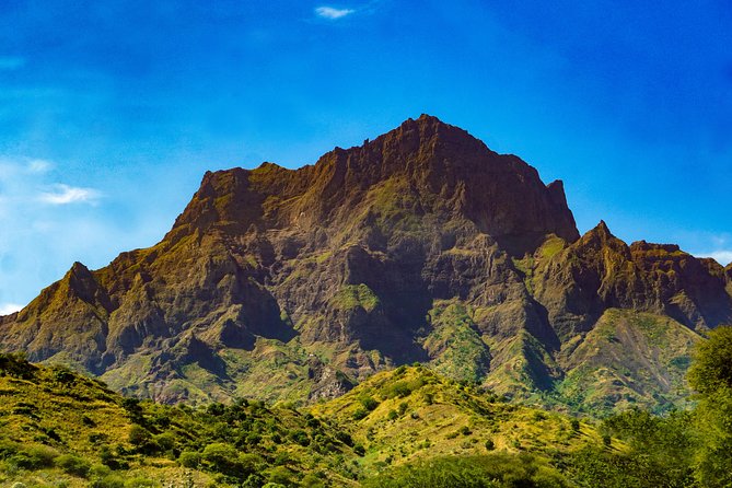
Pico D’Antónia is the star here, and the walk climbs to the highest point on Santiago Island at 1,394m. The hiking distance to the walking point is about 4.2 km up, so you get a meaningful ascent without spending all day grinding.
Once you reach the summit area, the tour builds in a tasty picnic lunch. This is a big deal for two reasons. First, food at altitude keeps energy steady for the descent. Second, it gives you a chance to slow down, look around, and enjoy the view without rushing to the next step.
Weather plays a role in the payoff. You’re told the panoramic views are weather dependent, and on clear days you might even see Fogo Island far on the horizon. That’s the kind of moment that makes people say the hike was worth it, but you shouldn’t count on it if the sky is hazy.
After the picnic comes the part your legs will remember: you descend steep rocks. This isn’t the time to be heroic. Keep your steps short, use your hands if the trail asks for it, and follow your guide’s pacing. It’s also where walking sticks (recommended) can be worth their weight in comfort.
The Longueira descent: agriculture you can taste, houses you can’t ignore
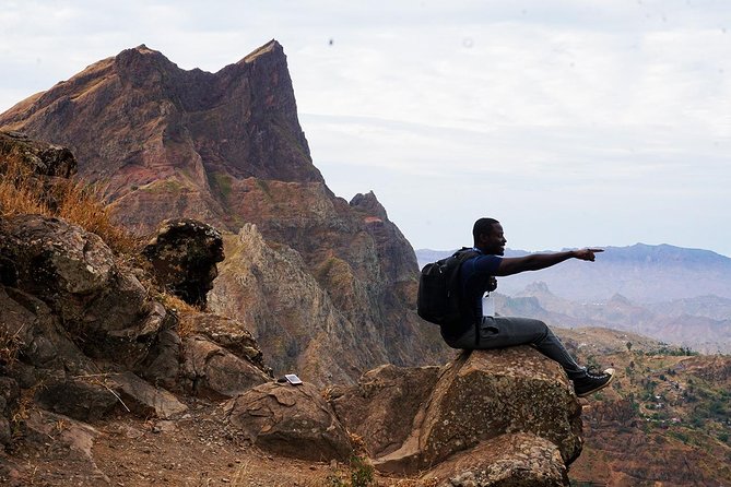
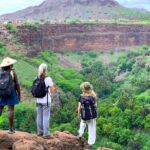
After the rocky descent, the route shifts into something special: walking through agricultural fields and mountain homes carved into the Longueira hills. Your guide will point out local farming tied to the season, so you might see corn, mango, coffee, or tomatoes as you go.
This section matters because it turns the hike into a conversation with the landscape. You’re not just passing through scenery—you’re moving through working ground, and the guide helps connect what you see to how people live here.
Then you reach the houses carved into the mountains. These aren’t just dramatic photo stops; the tour includes time to talk with a local family and hear about daily life in the region. That part is often what people remember most, because it makes the climb feel purposeful, not just athletic.
One practical note: the trails here are still described as narrow and uneven. The descent and the later village-and-farm walking can be slower than you expect, especially if you’re tired from the earlier climb. Plan to enjoy it at a steady pace rather than trying to cover every meter quickly.

What you’ll walk each day: distance, elevation, and why it feels hard
The route numbers give you a clear sense of the workload. Expect about 9 km total walking (listed as +/- 9 km) and roughly 660 m of elevation gain, with about 1,280 m of elevation loss. That imbalance explains the experience: the hike is a climb, but the return feels more like a long, careful downhill.
The max elevation is around 1,400m and the minimum is around 485m. You’ll also notice that the trail type is one way, with tilty, narrow paths that can demand balance and controlled movement.
The description also calls the overall degree of difficulty difficult, and it recommends travelers have strong physical fitness and no health problems that could be affected by hiking. There’s even a note that hiking pants are highly recommended from August to October, which suggests you’ll want extra leg protection during those months.
If you’re the kind of hiker who trains hills or does regular walks, you’ll probably feel confident. If your fitness is more casual, you can still manage it with a slow pace, but you need to go in honest about what difficult means on uneven mountain terrain.
Packing and safety tips that actually matter
This is the kind of hike where the right gear is the difference between a fun challenge and a sore, stressed scramble. The recommendations are straightforward: bring hiking shoes, hiking pants (especially August to October), and ideally walking sticks.
For comfort and safety, don’t skip the basics:
- Hat and sunscreen: you’ll be outside for hours.
- Water: you need it for both climb and descent.
- A weather mindset: panoramic views depend on conditions, and the hike requires good weather.
The tour emphasizes staying safe with an experienced local guide, and that matches what you’ll feel on the narrow sections. When the trail tightens and the grade increases, you want someone to show you where to place your feet and when to pause.
Also, with level 1 climbing in the mix, it’s smart to avoid thin-soled shoes. Even if you’re comfortable on flat trails at home, Santiago’s mountain paths are a different game.
Price and value: is $98.72 worth it?
The price is $98.72 per person, and the hike runs about 6 hours with pickup from Praia. On paper, that might look like a lot until you compare what you’re getting: a guided climb to the island’s highest point, endemic nature interpretation, a summit picnic, and the cultural stop with a local family.
The admission ticket for the park is listed as free, which helps the math. The value comes from the combination: transportation support, expert guidance, food at altitude, and a route that mixes nature with lived-in mountain culture.
Group size is small (max 8), so you’re not packed into a giant bus-style hike where nobody gets individual attention. The guide-to-group ratio matters on difficult terrain, and it’s worth paying for that kind of safety and pacing.
If you want only a view with no learning and no culture, you could find other hikes. But if you want a day that connects plants, birds, farming, and household life to the climb itself, this price-to-experience ratio feels fair.
Who should book Monte Tchota—and who should skip it
This works best for people who want a challenging hike and don’t mind uneven trails. The tour is suitable for walkers with some fitness and no health problems, and it’s for people over 16 years old.
You’ll be a good match if you:
- Like guided hikes with stops for learning
- Are comfortable with uphill effort and careful downhill steps
- Enjoy cultural encounters where you talk with a local family, not just watch from a distance
You might want to skip it if you:
- Avoid steep or rocky sections
- Struggle with balance on narrow paths
- Are sensitive to strenuous exercise or have health concerns that could be affected by hiking
If you’re unsure, the “difficult” label isn’t a suggestion. It’s a heads-up to bring strong walking stamina and realistic expectations.
Should you book this hike?
I think this is a strong booking if you want more than exercise. The summit picnic, the chance to learn about endemic plants and birds, and the visit to Longueira mountain homes give the day real meaning, not just a goal at the top.
But book it only if you’re ready for narrow, steep terrain and a controlled downhill. If you’re going to take the fitness side seriously—good shoes, pants, sticks, water—this hike becomes a memorable Santiago day with a guide-led pace that keeps you safe.
If the weather is questionable, consider waiting for a clear day too. The views and the possible sight of Fogo Island depend on conditions, and the tour requires good weather to run.
FAQ
What time does the hike start?
It starts at 8:30 am.
How long is the tour?
The total duration is about 6 hours, with around 4–5 hours of walking.
How hard is the route?
It’s rated difficult. The route is about 9 km one way, with roughly 660 m of elevation gain and steep downhill with narrow, tilted trails.
Is pickup available in Praia?
Yes. Pickup is offered in Praia, and you’ll also be dropped back at your hotel in Praia.
What is the hiking distance and elevation range?
Walking distance is listed as +/- 9 km. The route climbs to a maximum of about 1,400 m and down to a minimum of about 485 m.
Do I need an admission ticket?
Admission ticket is listed as free.
What should I bring for the hike?
Bring hiking shoes, hiking pants (highly recommended from August to October), a hat, sunscreen, water, and walking sticks are highly recommended.
How many people are in the group?
The tour has a maximum group size of 8 people.