REVIEW · PRAIA
Santiago: Monte Tchota Natural Park to Pico d’Antónia Hike
Book on GetYourGuide →Operated by Bu Country Tours · Bookable on GetYourGuide
One hard hike, then island-sized views. This trek through Monte Txota Natural Park climbs to Pico d’Antónia, Santiago’s highest point, with a real chance to look out over São Jorge Valley and even spot Maio and Fogo on clear weather days. I like the mix of cool, biodiverse park walking and that payoff view you can’t fake—because you earn it with your own legs.
The main consideration is that the hike is difficult: you’ll face a narrow, tilted path, a big elevation change, and a long day. If you want flat, easy, or fully “accessible,” this isn’t that kind of outing.
In This Review
- Key highlights at a glance
- Monte Txota to Pico d’Antónia: the payoff hike on Santiago
- Getting started: the drive to Rui Vaz and what the morning pacing means
- Inside Monte Txota Natural Park: cooler air and serious biodiversity vibes
- The climb toward Pico d’Antónia: steep enough to earn the views
- What makes the top special: São Jorge Valley plus distant islands
- The picnic stop: rest, fuel, and a good moment to take photos
- The return walk and how guides keep things safe on narrow trails
- Difficulty, trail conditions, and what to bring (so your day stays fun)
- Timing and expectations: how a 6-hour tour feels in real life
- Price and value: what $100 per person buys you
- Who should book this hike—and who should skip it
- What the guide experience is really like on this trail
- Should you book Santiago: Monte Txota Natural Park to Pico d’Antónia?
- FAQ
- How long is the Monte Txota Natural Park to Pico d’Antónia hike?
- How far is the trek?
- What’s the difficulty level?
- Where are pickups and drop-offs included?
- What languages are the guides available in?
- What food is included during the hike?
- What should I bring for the hike?
- Is the tour for everyone, including people with mobility or respiratory issues?
Key highlights at a glance
- Monte Txota’s micro-climate starts you in cooler air at about 800 meters, with lots of biodiversity around you
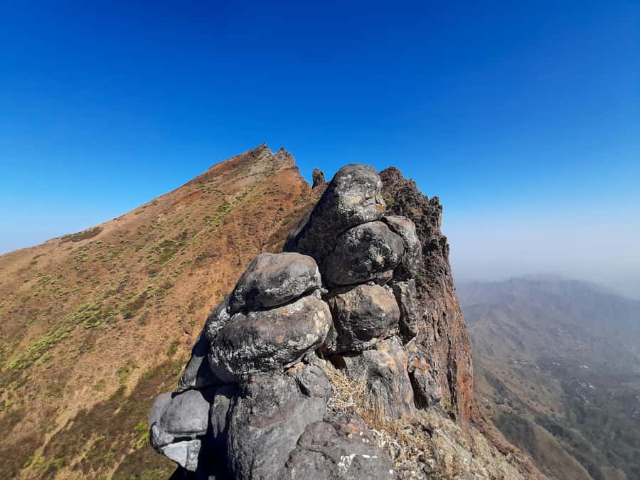
- Pico d’Antónia at 1,394 meters gives panoramic views over São Jorge Valley
- Distant island visibility: you may see Maio Island and the Volcano of Fogo when weather cooperates
- A proper workout with ~660 m elevation gain and roughly 9 km of trail
- Guides who pace you and keep safety tight on the steeper, narrower sections
- Picnic break with soft juice, sandwich, and fruit built into the climb
Monte Txota to Pico d’Antónia: the payoff hike on Santiago
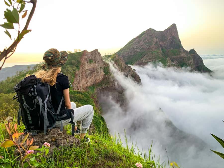
This is the kind of hike that makes sense on Santiago if you want something more than beaches and town walks. You’re trading easy sightseeing for a true climb through Monte Txota Natural Park, then hitting Pico d’Antónia, the highest point on the island. The reward is the long, wide view you get when you stand high enough to see how Santiago’s geography connects.
Two things I especially like here. First, the start is cooler and greener-feeling thanks to the park’s micro-climate—so the hike doesn’t feel like a single, endless grind in hot sun. Second, the view from the top is the tour’s whole reason to exist: São Jorge Valley in front of you, and, if the air is clear, possible glimpses of Maio and Fogo.
You can also read our reviews of more tours and experiences in Praia.
Getting started: the drive to Rui Vaz and what the morning pacing means
Your day typically starts with pickup from Praia or São Jorge dos Órgãos. The drive gets you to Rui Vaz, where the trek begins, and that matters more than you might think. It helps you start the hike earlier and in the right place for the route up toward Monte Txota and onward.
Most people feel the pace during the first hour. The climb doesn’t stay gentle forever, but getting there by car keeps the early energy focused on hiking rather than wasting time on transfers. When you’re paying attention, you’ll notice how quickly Santiago’s terrain changes as elevation rises—dry air at lower points, cooler air higher up, and a different feel underfoot as the path narrows.
Inside Monte Txota Natural Park: cooler air and serious biodiversity vibes
Monte Txota Natural Park sits at around 800 meters, and that altitude shift shows up fast. I love that the park walk isn’t just “pretty scenery”—it changes the temperature and the walking conditions. You can feel why it’s described as one of the coolest places on the island, even when lower areas are hotter.
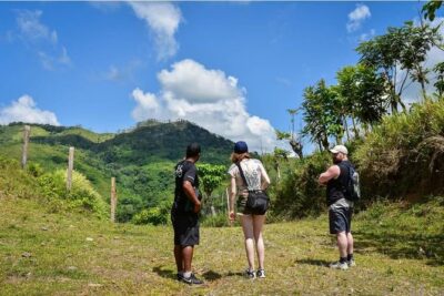
Trail conditions here are also part of the experience. The path quality is described as tilty, narrow, which means you’re not just hiking for distance—you’re hiking for balance. Your guide matters on sections like this, because good pacing and safe foot placement make the difference between feeling in control and feeling rushed.
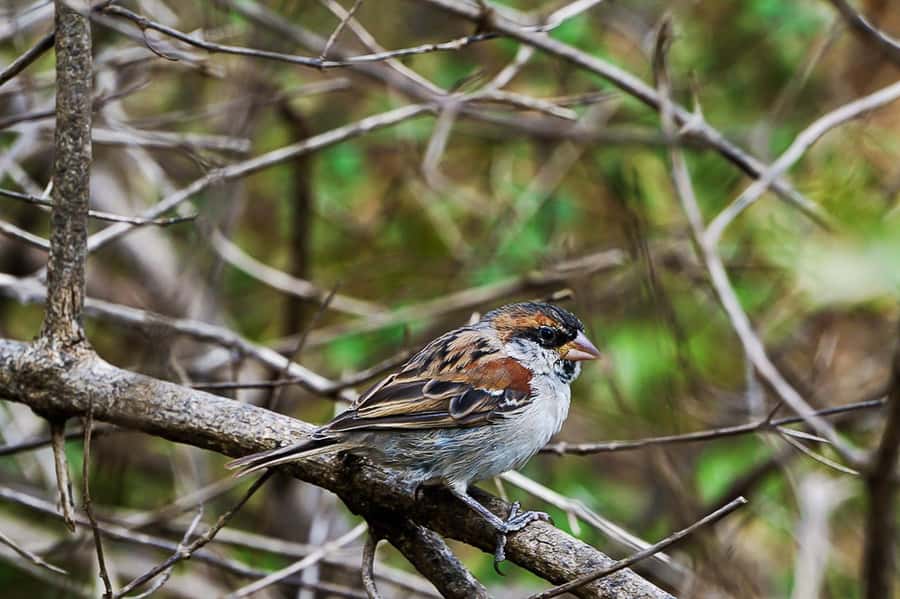
This is also where biodiversity comes into play. You’re not just moving through open land; you’re walking through a protected natural area with enough variety to keep your attention. Even if you’re not a plant nerd, the variety is the point: it breaks up the mind fatigue that can happen on long climbs.
The climb toward Pico d’Antónia: steep enough to earn the views
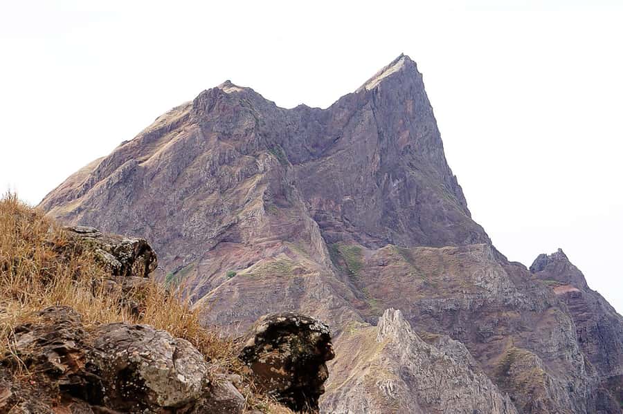
From Monte Txota you continue toward Pico d’Antónia, Santiago’s highest point at 1,394 meters. The tour’s elevation gain is listed at roughly 660 meters, and the elevation loss and change totals hint at a hike that rises, dips, and rises again rather than one smooth “line up.”
Expect a steady push. The route is described as difficult, and that matches what the numbers suggest. Add in narrow, tilted trail sections and you’ll quickly learn that this hike rewards hikers who slow down instead of rushing.
A helpful detail: level 1 climbing is possible on some trails, and the advice is to wear hiking pants, especially from August to November, plus bring hiking shoes and walking sticks if you have them. Even if you’re confident on hikes, sticks can turn a scary moment into a controlled step—especially on narrow edges where your stride wants to widen naturally.
What makes the top special: São Jorge Valley plus distant islands
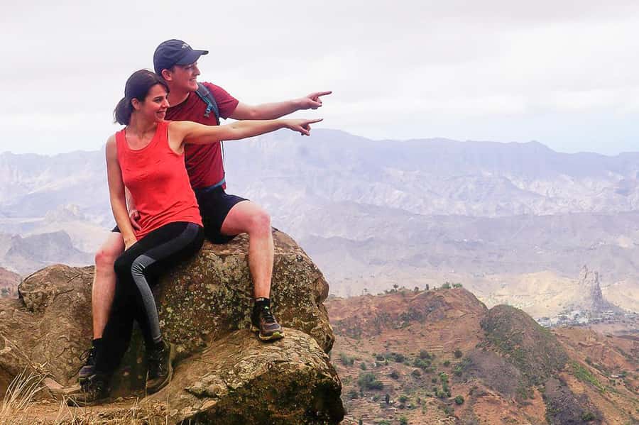
When you get close to the top, the view starts arriving in pieces. First you see angles of the route you just climbed, then you catch broader shapes of the terrain, and then you reach the panoramic moment the hike is built around.
From Pico d’Antónia, you’re looking toward São Jorge Valley. And if the weather is clear, you might see Maio Island and the Volcano of Fogo in the distance. That’s a big deal in the practical sense: Santiago’s mountains feel like their own world, and the distant islands help you understand the scale of the archipelago.
Keep your expectations flexible on the day. Visibility isn’t guaranteed, and the tour itself frames those island views as weather-dependent. Still, even without the far-distant fireworks, the valley viewpoint is substantial enough to feel like a real milestone.
The picnic stop: rest, fuel, and a good moment to take photos
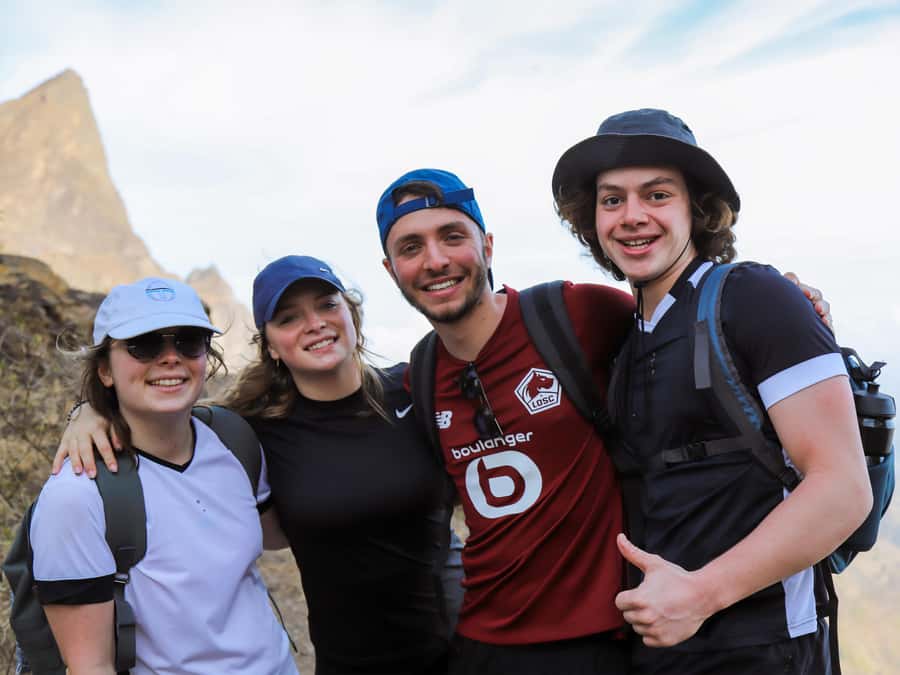
Your trek includes a stop for a small picnic. You’ll get soft juice, a sandwich, and fruit, which is a solid mix for a long half-day effort. This isn’t a fancy restaurant lunch—it’s a practical recharge so you can keep walking without feeling heavy or empty.
Use the break strategically. I’d treat it like a reset button: loosen your shoulders, sip water, and take a few photos while the light is still kind. Since the hike is listed as roughly 5 to 6 hours overall, you don’t want to spend all your energy at the top and then run out of steam on the return.
The return walk and how guides keep things safe on narrow trails
After reaching the viewpoint and finishing the time near the high point, you return toward Monte Txota Natural Park before the ride back to your accommodation. The return isn’t guaranteed to feel easier just because you’re going downhill. Narrow, tilted sections can still demand attention when your legs start to tire.
This is where having a strong guide earns its cost. In past experiences with this hike, guides have been praised for keeping groups at a pace that actually works for real bodies, not “tour bodies.” One name that stood out in feedback is Elder, described as helpful, empathetic, and focused on safety while also explaining nature in a way that’s easy to follow.
That matters for you because it changes how you feel during the harder moments. A guide who understands when to slow down, when to group together, and when to offer reassurance makes the climb feel more manageable.
Difficulty, trail conditions, and what to bring (so your day stays fun)
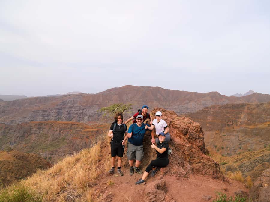
This hike is labeled difficult, and the details justify it. You’re dealing with about 9 km of trail, roughly 4 to 5 hours of walking time, and an elevation range from about 485 m up to around 1,400 m. The path is described as tilty, narrow, and some sections may involve light climbing.
So pack like you’re climbing, not sightseeing. The tour’s own list is a great baseline:
- Hiking shoes (not casual sneakers)
- Water and your own drinks if you like extra
- Sun hat and sunscreen
- Hiking pants (strongly advised, especially Aug–Nov)
- Walking sticks if you use them
You’ll be happiest if you plan for sun exposure and footwork. The weather can swing, too, so layers can help, but the data you have is already clear about cooling at higher altitude—Monte Txota’s micro-climate is part of the charm. Bring what keeps you comfortable on both warm starts and cooler higher sections.
Timing and expectations: how a 6-hour tour feels in real life
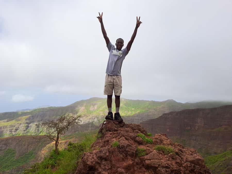
The full experience is listed as about 6 hours, with a total walking time around 4 to 5 hours. That makes this a practical “big day” that’s long enough to feel meaningful, but not so long you feel wrecked for the rest of your vacation.
Because it’s a one-day outing with pickup and drop-off, it also fits neatly into planning. You’re not committing to a multi-day expedition, but you’re still getting the kind of elevation gain that changes how you understand Santiago.
Start thinking about energy management early. If you go out too fast in the first climb, you’ll feel it later. If you pace smart and rely on your guide’s rhythm, the last part tends to feel more doable—even when the climb is still tough.
Price and value: what $100 per person buys you
The price is listed at $100 per person. For that, you get more than just “someone leads you on a path.”
You’re paying for:
- Pickup and drop-off at Praia or São Jorge dos Órgãos
- Transportation to the trail start
- A tour guide
- Liability insurance
- A picnic (soft juice, sandwich, fruit)
When I look at value, the key is risk and effort. On a difficult, narrow, tilted trail, the guide and transport reduce uncertainty and help keep the hike focused. Add in the picnic and insurance, and the cost starts to look less like a random add-on and more like a bundle that protects your time and your safety.
One note: pickup outside Praia can require an extra fee for pickup and drop-off. If you’re staying elsewhere, budget for that so the final cost matches your expectations.
Who should book this hike—and who should skip it
This tour is best for hikers who want a real workout and a real viewpoint. It’s suitable for people with some fitness and no health problems, and it’s for travelers over 16.
It’s not suitable for:
- Pregnant women
- People with mobility impairments
- Wheelchair users
- People with respiratory issues
If you’re unsure about your fitness level, treat the hike as difficult by default. You can still enjoy it by going steady and trusting your guide, but you shouldn’t plan it like an easy nature stroll.
If you’re the kind of person who likes learning while walking, you’ll likely enjoy the guide interaction. Feedback on Elder specifically mentioned explanations that were approachable, not just facts dumped at you mid-climb.
What the guide experience is really like on this trail
The guide isn’t just present for logistics. On a hike with narrow, tilted paths and a challenging climb, the guide shapes your whole comfort level.
In feedback, guides have been praised for:
- Keeping the group pace in a way that feels manageable
- Providing helpful information during the walk
- Watching safety closely during harder sections
- Being supportive when the hike gets tough
- Helping make the day feel like both exercise and education
This means you won’t be left to figure out the route alone. You’ll also get more from the hike because you’ll understand what you’re seeing—at a pace that fits a breathing human, not a classroom.
Should you book Santiago: Monte Txota Natural Park to Pico d’Antónia?
Book it if you want the best kind of Santiago memory: one you earn with effort and remember when you look back at the view from the highest point. The combination of Monte Txota’s cooler start, a difficult hike with a serious elevation climb, and the chance to see Maio and Fogo makes it a strong value day.
Skip it if you need easy walking, step-free routes, or have breathing or mobility concerns. Also skip if you’re not into long, physically demanding half-days—this trek is not designed to be casual.
If you do book, do it with the right mindset: pace smart, protect your feet, and bring water. When you arrive at Pico d’Antónia, you’ll understand why this route exists.
FAQ
How long is the Monte Txota Natural Park to Pico d’Antónia hike?
The tour duration is about 6 hours, with roughly 4 to 5 hours of walking time.
How far is the trek?
The trail distance is listed as approximately 9 km (shown as +/- 9 km).
What’s the difficulty level?
It’s described as difficult, with about 660 m elevation gain and a maximum elevation around 1400 m.
Where are pickups and drop-offs included?
Pickup and drop-off are included for accommodations in Praia or São Jorge dos Órgãos. If you are not in Praia, there may be an extra fee for pickup and drop-off.
What languages are the guides available in?
The live tour guide is offered in English, French, Spanish, and Portuguese.
What food is included during the hike?
You get a picnic with soft juice, a sandwich, and fruit.
What should I bring for the hike?
Bring a sun hat, drinks, hiking shoes, sunscreen, and water. Hiking pants are strongly advised.
Is the tour for everyone, including people with mobility or respiratory issues?
No. It’s not suitable for pregnant women, people with mobility impairments, wheelchair users, or people with respiratory issues. It’s for travelers over 16 years old.