REVIEW · ANTIGUA GUATEMALA
1 Day Acatenango Volcano Hike from Antigua
Book on GetYourGuide →Operated by Old Town Outfitters · Bookable on GetYourGuide
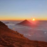
Acatenango is the kind of hike you remember. You start in the Guatemala highlands and climb through changing weather zones until a barren summit puts Volcán Fuego within sight.
What I like most is the variety of ecosystems on the same route: cornfields, old-growth cloud forest, then a cold, storm-worn summit with scree underfoot. The second big win is the time spent looking at Fuego up close—when conditions are right, you get dramatic eruptions while you’re actually up there, not watching from far away.
One consideration: this is steep, long, and cold at the top. It’s not a fit if your fitness level is low, and you’ll want proper hiking shoes because sandals simply won’t cut it.
In This Review
- Key points to know before you go
- From Antigua to La Soledad: the early start that sets the tone
- The first ascent phase: cornfields and the climb that warms you up
- Old-growth cloud forest: biodiversity, birds, and cooler air
- Higher views open up: volcano horizons and microclimate roulette
- Temperate forest to storm-battered tree line
- Summit scree and crater time: where you earn the waiting
- Watching Volcán Fuego from about 4 km away
- The descent to La Soledad: alternate routes and changing scenery
- Price and value: what $170 really covers
- What to pack (and what not to assume)
- Guides that matter: patience, skill, and real mountain work
- Who this Acatenango hike suits best
- Should you book this Acatenango hike with Old Town Outfitters?
- FAQ
- Where is the meeting point in Antigua?
- What time does the trip start?
- How long is the volcano hike?
- Is Volcán Fuego part of the plan?
- What microclimates do you hike through?
- How much time do you spend at the summit?
- What’s included in the price?
- What should I bring if it isn’t included?
- Who shouldn’t book this hike?
Key points to know before you go
- Four big microclimate changes on one climb, each taking about an hour.
- Old-growth tropical cloud forest with real biodiversity and birdlife.
- Summit waiting time for 360° views and a chance to see Fuego act up.
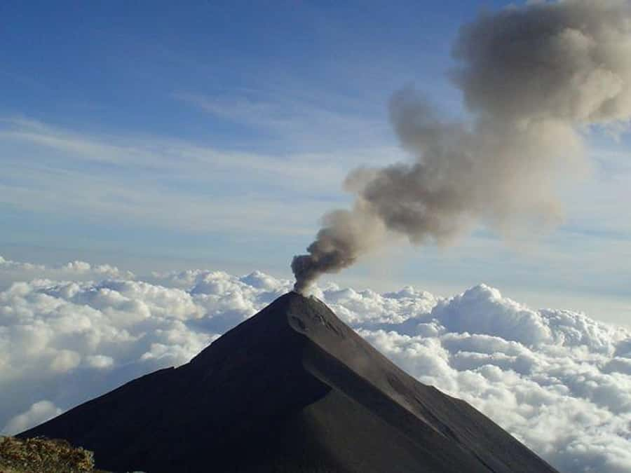
- Fuego is close enough to feel it—about 4 km away from the summit area.
- A night under the stars at camp is part of the experience, not just daytime trekking.
From Antigua to La Soledad: the early start that sets the tone
This is a day that begins before the rest of Antigua is awake. The plan calls for the group to meet at Old Town Outfitters (5a. Avenida Sur #12, one block south of Central Park, on the corner of 5th av and 6th calle) and then depart very early from the Antigua office. Expect a pre-dawn start, fill your water bottles before you head out, and eat breakfast ahead of time so you’re not climbing while your stomach is still catching up.
The drive takes about an hour to the sleepy village of La Soledad, perched on the ridge of the Pacific slope of Volcán Acatenango. That short transfer matters. It gets you out of the city rhythm and into mountain rhythm quickly. You also start the hike near where local people begin their daily work route—meaning the trail doesn’t feel like a theme park path. It feels like the way the mountain is lived with.
If you’re thinking, I’ll just bring a light layer and wing it, don’t. Even on a clear morning, you’re going from warming farm fields into cooler forest zones and then into wind at altitude.
You can also read our reviews of more tours and experiences in Antigua Guatemala.
The first ascent phase: cornfields and the climb that warms you up
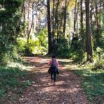
Your hike begins with a steep trail through local farm fields. This isn’t random scenery. You’re walking a route used by villagers each morning to reach their corn, snow pea, and lily plots. That gives the first stretch a special texture: it’s agricultural workland, not only wilderness.
This first phase is also your warm-up. You’ll spend roughly an hour climbing through the steepest early effort, getting your legs ready for the day. I like this structure because it makes it easier to settle into a steady pace. You’re not immediately dropping into cold cloud forest or scree without a ramp-up.
Practical tip: this is where you can judge how your body is handling effort. If you start too fast, the higher zones will punish you later. Start controlled, breathe, and keep moving.
Old-growth cloud forest: biodiversity, birds, and cooler air
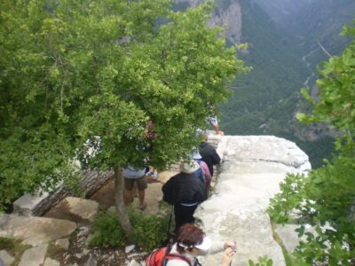
After the farm zone, you step into old-growth tropical cloud forest. This is the second of the microclimate stages, and it’s where the mountain feels alive in a different way—fresh air, old trees, and real bird sound.
On this part of the climb, you’re often surrounded by the kind of cloud-forest canopy that supports older Acatenango growth and a strong mix of plant life and wildlife. The area is also tied to one of Guatemala’s famous icons: the Quetzal. You might not see one (no guide can guarantee that), but the habitat is why birders come here.
Expect about an hour in this zone. It’s also a good time to slow your pace slightly and let your body adjust to cooler temperatures and changing light. If you brought sunglasses, keep them handy—visibility can shift quickly depending on cloud cover.
Higher views open up: volcano horizons and microclimate roulette
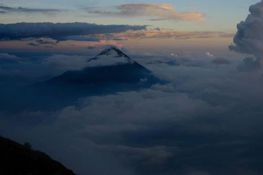
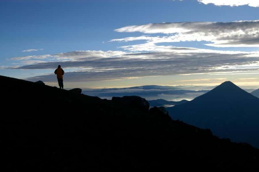
Once you exit the cloud forest, the climb starts paying you back with views. You’ll get strong sights of other highland volcanoes, including Atitlan, Tolimán, San Pedro, Santa María, Santo Tomás, and Tajamulco. On clear days, you can also catch glimpses of the Cuchumatanes Mountain chain.
This stage is where the mountain stops being one “destination” and becomes a system of shifting terrain. You’re watching the ecosystem change around you as much as you’re walking through it. One step you’re in forest tones; the next you’re looking out across big volcanic space.
The day also includes a fresh picnic lunch prepared for the group around midday. I’m glad this is built in, not tacked on later. When you’re climbing at altitude, it’s much easier to keep energy up when you’re not improvising a meal plan.
Temperate forest to storm-battered tree line
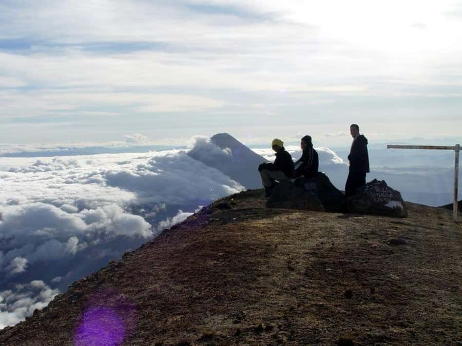
The third phase combines temperate coniferous forest and tropical dry forest, moving you toward the storm-beaten tree line. If you’ve ever heard people describe altitude as nature “running out,” this is that feeling. Trees thin. The air gets harsher. Wind seems more present.
This segment matters because it’s the bridge between lush and barren. It’s also where you feel the weather coming. As you approach the summit region, exposed rocky surfaces and gusty, cold winds shape how the mountain looks and how your body handles the climb.
You’ll also start seeing dwarf pine trees and high alpine mosses scattered through the route—small markers of the kind of life that survives where the conditions fight back.
Summit scree and crater time: where you earn the waiting
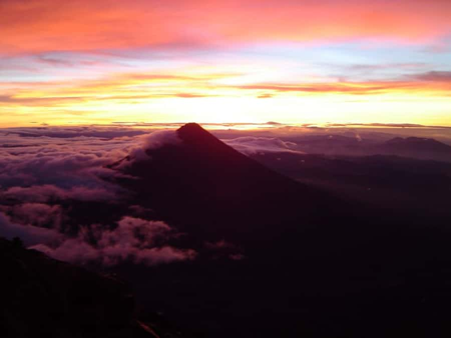
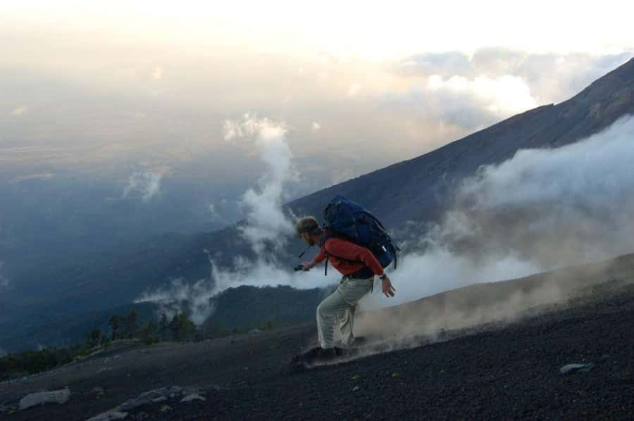
Acatenango’s summit brings the last push: sand and gravel scree trail. This is the “footing” zone, the place where you need traction and patience. Expect cold air, exposed surfaces, and wind that can make you feel instantly older than you are.
Once you reach the summit, the guide prepares a fresh picnic lunch so you can rest and take in the views. Then comes the main event: crater time and the chance to focus on what’s happening on the other volcano.
This is where you’ll get that big 360° panorama of Guatemala’s highlands. And it’s not just for photos. The views help you understand scale—the distance between volcanic peaks, how the ridgelines fold into valleys, and why this part of Guatemala is so dramatic even when you think you’ve seen mountains before.
Timing varies with conditions and the day’s plan, but you’ll spend around 30 minutes to an hour at the top before beginning the descent.
Watching Volcán Fuego from about 4 km away
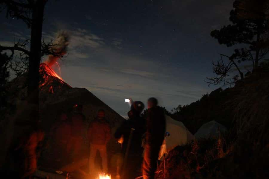
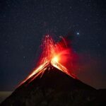
Volcán Fuego is the reason many people come. It’s active and close—about 4 km away from the summit area. The experience includes time specifically to watch Fuego erupt, and luck plays a role. When conditions align, you can get a high-altitude firework show: violent explosions of gas, rock, and lava that look nothing like a distant spectacle.
Here’s what’s valuable about this setup. You aren’t just hiking to a viewpoint and leaving. You’re timing your summit and waiting to align with viewing opportunities. That creates a different kind of memory. Instead of only “reaching the top,” you also experience the mountain as a living volcano system.
Also, plan for wind and temperature at the summit. Even if the day starts warm, the summit environment can make you feel chilled fast. Bring your warm layer (and don’t skip it thinking you’ll warm up later—your body cools as you stop moving).
The descent to La Soledad: alternate routes and changing scenery
After summit time, your group begins the descent back toward La Soledad. The descent is described as about three hours, depending on conditions and how the day unfolds.
There’s also an option to descend through an alternate route on Volcán Acatenango. That’s a big plus in terms of value: you’re not repeating every single step you took on the way up. You’ll see a different mix of microclimates and trail character, which helps the day feel longer and more varied rather than like a simple up-and-down exercise.
Once you reach La Soledad, you’ll head back toward Antigua with arrival in the afternoon, leaving you time to enjoy the old Spanish colonial city. In practice, this is the kind of hike that makes even a simple meal back in town feel earned.
Price and value: what $170 really covers
The price is $170 per person, and it’s worth looking at what’s actually included.
You’re paying for more than a guide. The package covers round-trip transportation from Antigua, park entrance fees, and a local guide from the community of La Soledad. You also get a bilingual guide (Spanish and English) and first-aid training. On top of that, you get food on the mountain: a freshly prepared picnic lunch/dinner.
That’s real value when you consider the logistics. Getting to La Soledad, managing entry fees, and coordinating a safe climb at altitude is not a DIY-friendly task. The guide’s job isn’t only navigation—it’s pacing, timing, and keeping the group together in conditions that can turn quickly.
That said, one note from feedback you should take seriously: food is considered fair for the price by some people. It’s not framed as a gourmet experience. So treat the meals as fuel for the hike, not a culinary highlight.
What to pack (and what not to assume)
This is where you can make the hike feel way easier—or way harder.
What you should bring:
- Comfortable shoes (no sandals)
- Sunglasses
- Sun hat
- Sunscreen
Recommended additions that are not included:
- A daypack with rain cover
- A warm layer and/or windbreaker
- A rain jacket for May through October
- A flashlight
- At least two liters of water (minimum)
- Personal toiletries/medications
Not allowed:
- Pets
- Luggage or large bags
If you only take one packing lesson from all of this, let it be the shoes and the warmth. The summit scree and wind matter. Improper footwear becomes a problem fast when you’re climbing and then descending rocky trail.
Guides that matter: patience, skill, and real mountain work
In guides, you’re buying judgment and steadiness. You’ll likely notice the difference between someone who can point and someone who can manage conditions and keep people moving safely.
Two guide names come up strongly: Gerson and Andrés. People specifically highlight Gerson’s patience and recommend him. They also describe Andrés as excellent. That lines up with what you want on a hike like this: calm instructions, good pacing, and a guide who can adapt when weather shifts.
Bottom line: pick the trip, and then pick it again if you see a guide you’re excited about—because the mountain demands good hands.
Who this Acatenango hike suits best
This isn’t a casual walk. It’s a full day of hiking with steep sections, changing zones, and summit exposure.
It’s not suitable for:
- Children under 16
- Pregnant women
- People with low level of fitness
Who it’s perfect for:
- You want an altitude hike with real scenery changes, not just one view
- You care about seeing Volcán Fuego erupt from close range (weather and timing matter, but the opportunity is built in)
- You like guided hikes where you get both interpretation and practical safety focus
And if you’re the kind of person who enjoys nature details—cloud forest birds, shifts in vegetation, and wind-sculpted summit rock—you’ll get extra satisfaction from the way the route is organized.
Should you book this Acatenango hike with Old Town Outfitters?
Yes, if your priority is a high-voltage mountain day: farms, cloud forest, and a summit built for watching Volcán Fuego. The $170 price makes more sense when you factor in transportation, fees, a local community guide, bilingual guiding, and meals on the mountain. Add in the summit crater waiting time and the evening under the stars, and this becomes more than a standard “volcano viewpoint” outing.
Skip it if you hate cold wind at altitude, can’t handle steep rocky descent, or you’re expecting a relaxed stroll. Also, be honest about footwear and warmth. You don’t want the hike to be hard for the wrong reasons.
If you want a little flexibility, the tour includes free cancellation up to 24 hours in advance for a full refund, which makes it easier to plan around weather.
FAQ
Where is the meeting point in Antigua?
You meet at Old Town Outfitters at 5a. Avenida Sur #12, on the corner of 5th av and 6th calle, one block south of Central Park.
What time does the trip start?
The details mention an early departure from the Antigua office at 5:00am, and they also list a meeting at Old Town Outfitters at 9:00am. Check your confirmation for the exact timeline for your departure.
How long is the volcano hike?
The experience is listed as 1 day.
Is Volcán Fuego part of the plan?
Yes. The itinerary includes time to watch the active Volcán Fuego erupt, about 4 km away, from the summit area.
What microclimates do you hike through?
You’ll hike through steep farm fields, old-growth tropical cloud forest, then temperate coniferous forest and tropical dry forest, and finally a storm-battered, scree trail toward the summit.
How much time do you spend at the summit?
You’ll spend about 30 minutes to 1 hour at the summit, depending on conditions and time considerations.
What’s included in the price?
Included are round-trip transportation from Antigua, park entrance fees, a local guide from the community of La Soledad, freshly prepared picnic lunch/dinner served on the mountain, and a local bilingual guide with certified first-aid training.
What should I bring if it isn’t included?
Bring comfortable shoes (no sandals), sunglasses, a sun hat, and sunscreen. The tour also suggests you bring a daypack with rain cover, a warm layer/windbreaker, a rain jacket for May through October, at least two liters of water, and a flashlight.
Who shouldn’t book this hike?
It’s not suitable for children under 16, pregnant women, or people with low level of fitness.