REVIEW · GRAN CANARIA
Gran Canaria: “Peaks of Gran Canaria” Hiking Tour
Book on GetYourGuide →Operated by GC Active Tour · Bookable on GetYourGuide
This hike takes you above the postcard views fast. You’re in the central highlands near Pico de las Nieves, with possible lookouts toward Roque Nublo and even Tenerife’s Teide when visibility plays along.
What I like is the way it’s built like a full-day mountain program, not just a walk. You get a UIMLA-certified international mountain guide, plus hiking poles, lunch, insurance, and hotel transfers—so you can focus on footing and photos instead of logistics.
One thing to weigh: the hike is not a stroll. Distances and climb change by day and season, and some rocky, steep bits can feel tough if you’re brand-new to hiking—especially in mud, wind, or fog.
In This Review
- Key things to know before you go
- The Central Peaks Get You Away From the Beach Fast
- Hotel Pickup in the South: The Easy Part, If You Match the Areas
- Trek Specs: 7 km vs 10 km and What the Climb Really Means
- Near Pico de las Nieves: The Views Are the Point
- Canarian Pine Forests and Rock Formations: What You Walk Through
- The Pace: Why So Many Stops Feel Like a Feature, Not a Delay
- Lunch at a Local Restaurant: Where the Day Becomes a Meal
- Guide Quality: UIMLA Credentials Plus Real-World Trail Sense
- What to Bring: The Small Items That Save the Day
- Price and Value: Why $82 Can Actually Make Sense
- Who Should Book This Peaks of Gran Canaria Hike
- Should You Book It? My Straight Answer
- FAQ
- How long is the Peeks of Gran Canaria hiking tour?
- How far will I hike?
- What is the ascent and descent?
- What’s the maximum and minimum elevation?
- How difficult is the hike?
- What’s included in the price?
- Are hotel transfers included?
- Where is pickup available?
- What languages does the guide speak?
- What should I bring, and what is not allowed?
- Is the hike offered in summer?
Key things to know before you go
- Small group size (4–8) with a 9-seater AC minibus means you can actually hear your guide and move at a human pace.
- UIMLA guide + safety-first breaks helps when the trail gets rocky or slippery.
- Route varies by day and season (7 km or 10 km, different ascent/descent totals).
- Big-view moments are timed for conditions, so fog can change what you see from the high points.
- Lunch at a local restaurant turns the hike into a real meal—not a snack-and-run.
The Central Peaks Get You Away From the Beach Fast
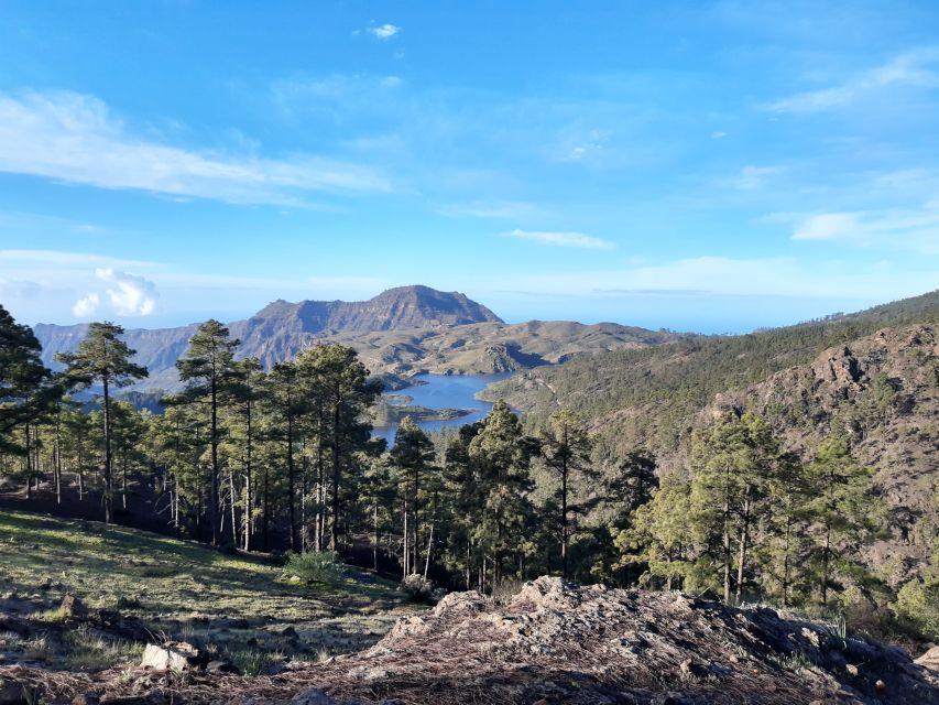
Gran Canaria is famous for sun, but the middle of the island is where you start to feel the “other side” of the country. This tour is set up for that switch. You leave from the south coast side (think Meloneras, Maspalomas area, Playa del Inglés, San Agustín, and Bahia Feliz), then you ride into the highlands for a full day.
A big practical win here is that you don’t have to plan the drive into the mountains yourself. The transport is handled by an air-conditioned 9-seater minibus, and the group is kept small. On Gran Canaria, mountain roads can feel twisty and steep, so having a driver whose job is the route matters.
The tour lasts about 9 hours total, but the hiking time is shorter: roughly 3.5 hours for the ~7 km option and about 4.5 hours for the ~10 km option. That split is smart. You’re out in nature long enough to feel like you did something, without turning the day into pure suffering.
You can also read our reviews of more tours and experiences in Gran Canaria.
Hotel Pickup in the South: The Easy Part, If You Match the Areas
This experience is designed around hotel pickup from the south and southeast. If you’re staying in the south, you’re likely in the sweet spot. The pickup windows listed include:
- Faro Meloneras around 08:35–08:40
- Sonnenland around 08:30–08:40
- Playa del Inglés around 08:40–08:50
- San Agustín around 08:45–08:55
- Bahia Feliz around 09:00
Two timing details are worth taking seriously. First, the automatically shown 9:00 AM time is not necessarily your pickup time. You’ll get the real pickup time the evening before. Second, there’s no pickup option from the north side (including Las Palmas de Gran Canaria) and several other areas on the south/west side.
If you’re in a hotel on the pickup list, the start of the day feels straightforward: wait outside reception, be ready, and roll. If you’re not, you’d be better off picking a different excursion or arranging your own connection, because this one is clearly built around those set pickup zones.
Trek Specs: 7 km vs 10 km and What the Climb Really Means
The tour includes different route versions depending on the day and the time of year. The key is that you’re hiking in altitude territory: the route is described with a minimum height of 1650 m and a maximum height of 1917 m. You’re also near Pico de las Nieves (1957 m), depending on the exact path.
Here’s the structure you can plan around:
- Monday: about 10 km, with ~400 m ascent and ~400 m descent
- Sunday and Wednesday: about 7 km, with ~300 m ascent and ~300 m descent
- May 15 to Sep 30: the route shifts to about 7 km with ~250–300 m ascent/descent and roughly ~3.5 hours hiking time
Difficulty is labeled as Physical effort 2 and Technical difficulty 1.5. That combination usually means: expect some uneven ground, but not expert climbing. Still, there are two “real life” factors that make this hike feel harder than the numbers suggest:
- Altitude and exposure. Even if the climb isn’t huge, being up high can wear you out.
- Weather. Fog, rain, and wind can turn stones into slippery obstacles.
The good news: the total day time includes lots of breathing room. The hike portion is often paced so you’re not sprinting between viewpoints. You should still come prepared to walk for hours, though—this isn’t a sit-down sightseeing tour.
Near Pico de las Nieves: The Views Are the Point
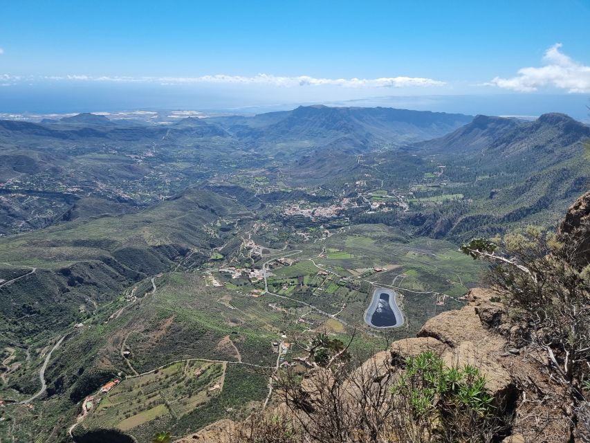
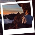
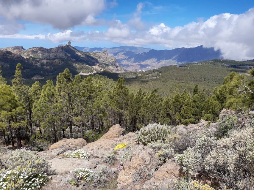
The most memorable part is the view network you’re chasing. The route passes tracks in the central island area and aims for viewpoints that connect you to the rest of Gran Canaria.
Here’s what you’re likely working toward:
- Roque Nublo in the neighboring area (a major photo magnet on the island)
- Views over the east and south coasts
- On clear days, a sightline toward Pico de Teide (3718 m) on Tenerife
Visibility is the variable. High points can be clouded over even when the coast looks fine. When that happens, you still hike through a really scenic highland area—just with fewer distant horizons. That’s why this tour’s emphasis on weather-aware guiding is so valuable.
Also, keep in mind that altitude hikes can feel windy. Even when the day starts mild, the top can feel sharp. A jacket is listed as a must-bring item for a reason, and you’ll feel better if you pack for temperature swings rather than assuming the coast forecast equals the mountains.
Canarian Pine Forests and Rock Formations: What You Walk Through
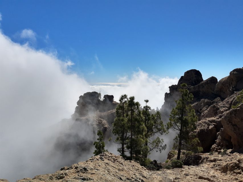
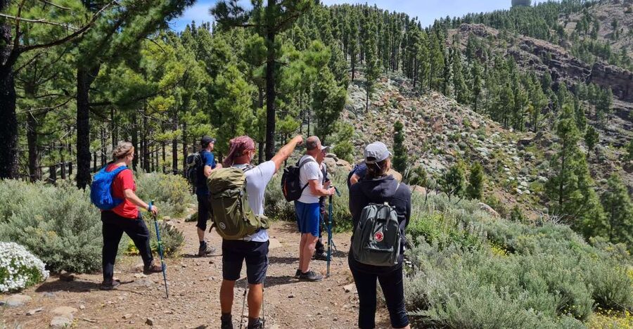
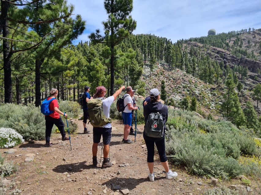
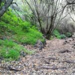
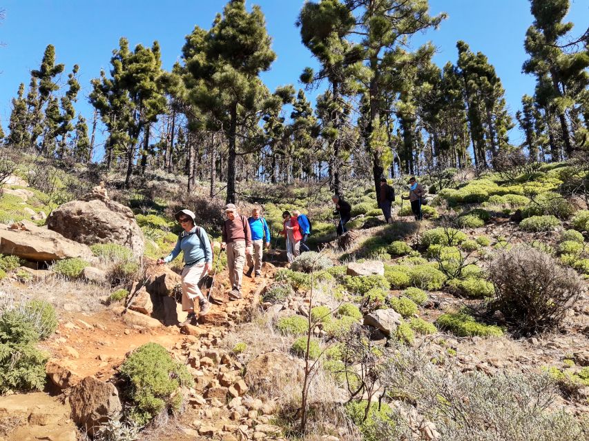
Gran Canaria’s interior doesn’t look like “classic” Europe. It has a mix of rocky paths, dramatic formations, and patches of Canary pine forest. Part of the appeal of this tour is that it’s not just a single long ridge walk.
You’ll be moving through:
- Rock formations that make the ground look volcanic and sculpted
- Areas of pine-covered forest that cool things down a bit
- Passing by villages and countryside viewpoints during the day
Some groups may also see or reference places like Santa Lucía, Tunte, and Fataga as part of the route or stopping area. Whether you get more village scenery versus more peak-time depends on the day’s chosen path, but the overall feel is consistent: you’re walking through the island’s high interior, not just around one lookout.
If you’re the type who likes nature photography, this mix is what helps you avoid boredom. There’s texture everywhere—stone color changes, pine needles move in the wind, and every bend can open a new angle.
The Pace: Why So Many Stops Feel Like a Feature, Not a Delay
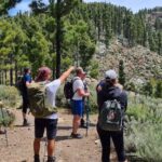
The tour is built with a guide who keeps the group together and stops often. That might sound slow if you’re expecting a marching pace, but it’s usually the difference between a hike that feels doable and one that feels like a chore.
From the way the hike is described, the total trek time is only part of the story; the day is also filled with:
- short rest breaks
- time to take photos
- explanations about the plants and the area
That approach matters on this kind of trail because it prevents “overreach.” If you push too hard early, the higher sections can beat you up. A slow, controlled pace helps you enjoy the views without arriving at the top already worn out.
Also, that frequent stopping makes solo travel easier. You’re not left in the group’s dust. You get time to ask questions, and you don’t have to constantly check the pace chart in your head.
Lunch at a Local Restaurant: Where the Day Becomes a Meal
This is a big part of the value. After the hike, you go to a local restaurant for regional dishes. Food and drinks are included, and the day is framed so you actually work up an appetite.
What to expect from the meal setup:
- You’re eating at a local restaurant after hiking
- Reviews-style feedback points to options like fish with mojo sauce
- People also note favorites like gofio dessert
- Vegetarian options are mentioned as available
- There’s usually a drink included with the meal (you may see local beers mentioned alongside lunch)
Even if you’re not a huge foodie, this meal is practical. It gives your legs a clean stop, and it turns the hike into a full outing rather than a quick morning activity.
One small extra detail that can help you plan photos: there’s often a chance to browse a small shop area across from the restaurant, which can be handy if you want a souvenir without hunting.
Guide Quality: UIMLA Credentials Plus Real-World Trail Sense
The tour is led by a UIMLA international mountain guide. That matters because mountain hikes are about decision-making, not just walking.
In real conditions, weather can change fast. The route has options that run lower or adjust timing when fog rolls in. That’s the difference between seeing distant landmarks and hiking under a ceiling of cloud.
A strong guide also handles:
- group pace so everyone stays safe
- trail choices that fit the group’s ability
- explanations on what you’re walking through (plants, rock features, and island context)
Language is also part of the quality package. Commentary is offered in English, Polish, Spanish, and German, and you’ll have a better day if you’re not forced to listen in a language you don’t fully get.
What to Bring: The Small Items That Save the Day
The tour provides hiking poles, but you still need the right base gear. Here’s what’s explicitly recommended:
- Hiking shoes (no sandals or flip-flops)
- Sunscreen
- Water
- Jacket and weather-appropriate clothing
- Trekking gear / sports shoes if appropriate for you
A couple practical upgrades you might consider:
- If you get cold hands easily, thin gloves can help with grip on wet stones in rainy conditions.
- If you know you sweat a lot, bring an extra layer you can shed without slowing the group.
Also, there’s a clear rule: no food and drinks in the vehicle. It’s not a dealbreaker, but it keeps the ride tidy and avoids spills in a small minibus.
Price and Value: Why $82 Can Actually Make Sense
At about $82 per person for a 9-hour outing, the value depends on what you compare it to. If you were to do this on your own, you’d pay for transport, likely a guide (or a lot of route research), and you still wouldn’t get a structured meal at the end.
Here’s what your ticket already covers:
- a licensed international mountain guide
- food and drinks
- hiking poles
- insurance
- transport from/to your hotel (from the listed pickup areas)
That combination is what makes the price feel fair. You’re paying for reduced hassle, not just for the trail itself. And because the group is small, you’re not buying a seat on a crowded bus with a generic walk.
Who Should Book This Peaks of Gran Canaria Hike
This tour fits best if you:
- want mountain views without handling route planning
- like guided explanations while you walk
- prefer a small group experience
- can handle rocky paths at altitude for a few hours
It may feel like a challenge for true beginners. The effort level is moderate, but reviews-style feedback highlights that someone with zero hiking experience could find some sections overwhelming—especially with mud, wind, or wet rocks.
It also doesn’t run during July 1 to August 31. If your trip lands in midsummer, double-check dates before you commit.
Should You Book It? My Straight Answer
If you’re staying in the south and want one high-impact day in Gran Canaria’s interior, I think this is a smart booking. You get the mountains, you get the viewpoints, and you don’t have to manage the logistics or guess at the route. The small-group setup and the UIMLA guide make it feel safer and more enjoyable than doing it solo.
Skip it or plan differently if you’re traveling outside the pickup zones, you’re in a strict midsummer window, or you know you’re not comfortable walking uneven ground for hours at altitude.
FAQ
How long is the Peeks of Gran Canaria hiking tour?
The tour runs about 9 hours total, with hiking time around 4.5 hours for the 10 km route and about 3.5 hours for the 7 km route.
How far will I hike?
Distance depends on the day/season: around 10 km on Monday, and about 7 km on Sunday and Wednesday. From May 15 to Sep 30, it’s about 7 km.
What is the ascent and descent?
For the 10 km Monday route, it’s about 400 m ascent and 400 m descent. For the 7 km Sunday/Wednesday route, it’s about 300 m ascent and 300 m descent. From May 15 to Sep 30, it’s about 250–300 m ascent and 250–300 m descent.
What’s the maximum and minimum elevation?
The route is listed with a minimum height of 1650 m and a maximum height of 1917 m.
How difficult is the hike?
Difficulty is listed as Physical effort 2 and Technical difficulty 1.5.
What’s included in the price?
Included items are a licensed international mountain guide, food and drinks, hiking poles, insurance, and hotel transport from/to your selected pickup option.
Are hotel transfers included?
Yes. You choose a hotel pickup from the available list, and pickup timing is provided after booking.
Where is pickup available?
Pickup is available from listed south-side locations such as Meloneras, Campo Internacional, Sonnenland, Playa del Inglés, San Agustín, and Bahia Feliz. There is no pickup option from Las Palmas de Gran Canaria (north of the island).
What languages does the guide speak?
The live tour guide provides commentary in English, Polish, Spanish, and German.
What should I bring, and what is not allowed?
Bring hiking shoes, sunscreen, water, a jacket, and weather-appropriate clothing (plus trekking gear). Sandals or flip-flops are not allowed, and you should not bring food and drinks into the vehicle.
Is the hike offered in summer?
During July 1 to August 31, hiking trips are not organized.